Monte Estância
| Monte Estância | |
|---|---|
 Monte Estância | |
| Highest point | |
| Elevation | 387 m (1,270 ft) |
| Prominence | 387 m (1,270 ft) |
| Listing | List of mountains in Cape Verde |
| Coordinates | 16°02′48″N 22°45′18″W / 16.04667°N 22.75500°WCoordinates: 16°02′48″N 22°45′18″W / 16.04667°N 22.75500°W |
| Geography | |
 Monte Estância southeastern Boa Vista | |
| Geology | |
| Mountain type | Stratovolcano (extinct) |
| Last eruption | unknown |
| Climbing | |
| First ascent | unknown |
| Easiest route | road and hiking |
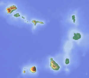
Monte Estância is a mountain in the southeastern part of the island Boa Vista in Cape Verde. At 387 m elevation, it is the island's highest point.[1] It is located 23 km southeast of the island capital Sal Rei and not far from João Barrosa. The Atlantic Ocean is about 4 kilometres to the southeast and approximately 10 km to the west Monte Santo António or Pico, the island's second highest point. The mountain is entirely of volcanic origin. Almost the whole mountain area has no vegetation and is considered as the island's "countryside icon" and is seen throughout much of the island.
It is part of a protected natural space in Cape Verde under the statute of natural monument, a reason that describes geological and geomorphical features. It also protects notable endemic plants and flowers and endangered birds. The protected area covers 736 ha and its boundary is 10.947 km long.
See also
References
- ↑ Busquets i Fábregas, p. 584
Further reading
- Jaume Busquets i Fábregas and Alberto Cortina Ramos, Gestión del paisaje, Editorial Ariel, Barcelona, 2009 ISBN 9788434428904
- REITMEIER, Pitt and FORTES, Lucete. Goldstadt Hiking Map Boa Vista Sal Maio 1 : 50,000. Goldstadt-Verlag 2004. ISBN 3-89550-470-X
- Ricardo A. S. Ramalho, Building the Cape Verde Islands, Springer, 2011, p. 101
External links
The island of Boa Vista and the surrounding islands | ||
|---|---|---|
| Communities and settlements |  | |
| Parishes | ||
| Mountains | ||
| Beaches | ||
| Other geographical features |
| |
| Features surrounding the island |
| |