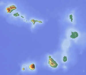
Monte Caçador and Pico Forcado Protected Countryside
| Monte Caçador Pico Forcado Mesa Cágado | |
|---|---|
 Monte Caçador Pico Forcado Mesa Cágado Location in Cape Verde | |
| Highest point | |
| Elevation | 364 m (1,194 ft) |
| Coordinates | 16°7′N 22°46′W / 16.117°N 22.767°WCoordinates: 16°7′N 22°46′W / 16.117°N 22.767°W |
| Geography | |
| Location | East central Boa Vista |
| Geology | |
| Mountain type | Stratovolcano (extinct) |
| Last eruption | unknown |
| Climbing | |
| First ascent | unknown |
| Easiest route | road and hiking |
Monte Caçador and Pico Forcado Protected Countryside (Portuguese: Paisagem protegido de Monte Caçador e Pico Forcado) is a protected area covering 3,367 hectares (13.00 sq mi) of land[1] on the island of Boa Vista in Cape Verde. Its boundaries extend up to the area named Olho do Mar.
The alignment of the peaks forms a tiny mountain range that consists Monte Caçador (355 metres [1,165 ft], the fourth highest on the island), Pico Forcado (364 metres [1,194 ft], the third highest on the island) and the lesser Mesa Cágado (297 metres [974 ft]).
It forms an orographic boundary with the Monte Passarão Formation, which forms a large part of the west central part of the island; the formation is the most important in Boa Vista Island. It is made up of peaks, mesas and other features. Surrounding the feature is an area of plain which covers the western portion, named Campo da Serra, and a plain where a creek named Ribeira do Norte is located.[2]
The rock formation consists of phonolitic rocks and ankaramite of the Fundo de Figueiras Formation. Another formation is of that of Pico Forcado, which consists of subarid lava-originated rocks and sediments in the other parts. The marine sediment consists of calcarenite and limestone rocks. The rock formation was formed around 13 to 12 million years ago.[2]
See also
References
- ↑ Áreas protegidas, Cabo Verde (Portuguese)
- 1 2 Ramalho, R. (2010). Tracers of uplift and subsidence in the Cape Verde Archipelago.
