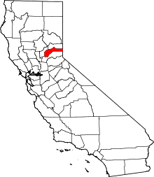
Maybert, California
| Maybert | |
|---|---|
| Former settlement | |
 Maybert Location in California | |
| Coordinates: 39°21′10″N 120°41′59″W / 39.35278°N 120.69972°WCoordinates: 39°21′10″N 120°41′59″W / 39.35278°N 120.69972°W | |
| Country |
|
| State |
|
| County | Nevada County |
| Elevation[1] | 3,245 ft (989 m) |
Maybert is a former settlement in Nevada County, California. Situated at an elevation of 3,245 ft (989 m) above sea level,[1] it still appeared on maps as of 1902.[1] Maybert is located on the South Yuba River, 5.5 miles (8.9 km) south-southeast of Graniteville.[2] Maybert is 6 miles upriver from the town of Washington, CA, accessible via the Maybert Road. The historic Yuba Mine is located at the Maybert town site. The Yuba mine was once owned by members of the Hearst family (of Hearst Castle fame).
A post office operated at Maybert from 1886 to 1905 and again from 1907 to 1910.[2] The name comes from the Maybert mine nearby.[2]
Up until the 1960s, some cabins remained and were occupied by squatters. The forest service, with the property-owner's permission, burned the remaining buildings to the ground to drive the squatters out and avoid the risk of wildfire from people squatting there. (Family story of a former property owner).
Today, there are few remains of the old town site, but the area is popular with hikers, campers and fishermen.
The land is privately held, but surrounded by the Tahoe National Forest.
