Tangiteroria
| Tangiteroria | |
|---|---|
 Tangiteroria | |
| Coordinates: 35°49′17″S 174°2′41″E / 35.82139°S 174.04472°E | |
| Country | New Zealand |
| Region | Northland Region |
| District | Kaipara District |
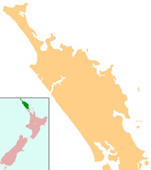
Tangiteroria is a small rural community in the North Island of New Zealand. It is located halfway between Whangarei and Dargaville on State Highway 14 on the banks of the Northern Wairoa river.
It consists of a primary school, service station, pub, Catholic church, marae and community centre (pot luck dinner once a month on a Friday). The local cricket team play either Kirikopuni or Pukehuia once a week through the summer.
Kirikopuni and Pukehuia both had railway stations on the Dargaville Branch for the movement of stock throughout Northland and a passenger service.
History
A Wesleyan mission station was set up by James Wallis in 1836,[1] and then run by James Buller.[2] The station lasted until 1853.[3] Kauri logs were sent down the river to be milled in the mid-1860s.[4] A flax mill operated in the late 19th century.[5]
A steamer service up the Wairoa River was established to Tangiteroria by the Tangihua in 1878, and Watson's Landing and store flourished there in 1881. The S.S. Blanche ran a service between Dargaville and Tangiteroria in 1891-2, and the S.S. Ethel was doing the run twice a week in 1896. It was replaced by the S.S. Naumai from 1903-1920. The service finished in 1929[6] Road access was established in the 1890s.[7]
Education
Tangiteroria School is a coeducational full primary (years 1-8) school with a decile rating of 5 and a roll of 55.[8] The school was established in 1886.[9]
Notes
- ↑ Ryburn, Wayne (1999). Tall Spars, Steamers & Gum. p. 9. ISBN 0-473-06176-7.
- ↑ Byrne, Brian (2002). The Unknown Kaipara. pp. 81–96, 121–9, 307. ISBN 0-473-08831-2.
- ↑ "Waipoua and middle Northland". Te Ara Encyclopedia of New Zealand.
- ↑ Ryburn, p 40
- ↑ Ryburn, p 139
- ↑ Ryburn, pp 55, 77, 79-81, 177
- ↑ Ryburn, p 93
- ↑ "Te Kete Ipurangi - Tangiteroria School". Ministry of Education.
- ↑ "Tangiteroria School".
Coordinates: 35°49′S 174°03′E / 35.817°S 174.050°E