Spa-La Sauvenière Airport
| Spa-La Sauvenière Airport Aérodrome de Spa-La Sauvenière | |||||||||||
|---|---|---|---|---|---|---|---|---|---|---|---|
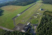 Aerial view of the airfield | |||||||||||
| IATA: none – ICAO: EBSP | |||||||||||
| Summary | |||||||||||
| Airport type | Private | ||||||||||
| Operator | Service Public de Wallonie | ||||||||||
| Location | Spa, Belgium | ||||||||||
| Elevation AMSL | 1,542 ft / 470 m | ||||||||||
| Coordinates | 50°28′57″N 005°54′37″E / 50.48250°N 5.91028°ECoordinates: 50°28′57″N 005°54′37″E / 50.48250°N 5.91028°E | ||||||||||
| Map | |||||||||||
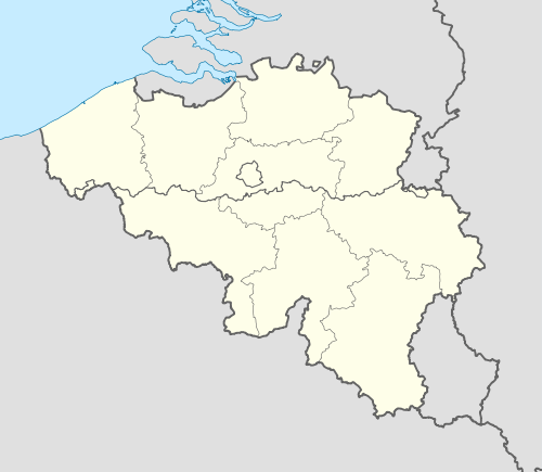 EBSP Location in Belgium | |||||||||||
| Runways | |||||||||||
| |||||||||||
Spa-La Sauvenière Airport (ICAO: EBSP) is a general aviation airfield located in Spa, a municipality of Belgium. The airport is privately managed and home to the Royal Aéro Para Club de Spa (RAPCS). Paradropping activities are in progress during all the year by the Skydive Spa[2] Company and there is also a company with 1 or 2 helicopters called Heli&Co .
See also
References
External links
This article is issued from Wikipedia - version of the 12/4/2016. The text is available under the Creative Commons Attribution/Share Alike but additional terms may apply for the media files.