Somerford, Cheshire
| Somerford | |
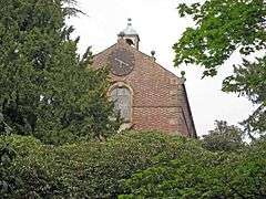
 All Saints Chapel, Somerford |
|
 Somerford |
|
| Population | 430 (2011) |
|---|---|
| OS grid reference | SJ821633 |
| Civil parish | Somerford |
| Unitary authority | Cheshire East |
| Ceremonial county | Cheshire |
| Region | North West |
| Country | England |
| Sovereign state | United Kingdom |
| Post town | CONGLETON |
| Postcode district | CW12 |
| Dialling code | 01260 |
| Police | Cheshire |
| Fire | Cheshire |
| Ambulance | North West |
| EU Parliament | North West England |
| UK Parliament | Congleton |
Coordinates: 53°09′58″N 2°15′58″W / 53.166°N 2.266°W
Somerford is a civil parish in the unitary authority of Cheshire East and the ceremonial county of Cheshire, England. It is adjacent to the north west of Congleton, from which town it has some housing overflow. According to the 2001 census, the population of the civil parish was 343,[1] increasing to 430 at the 2011 Census.[2]
Somerford Park was the site of a Georgian country house demolished in 1926. The park has now been restored to farming and an equestrian centre. All Saints Chapel was built in 1720 as a chapel to Somerford Hall. It still stands and is listed at grade II*.[3]
References
- ↑ 2001 Census figures for Somerford civil parish. Neighbourhood Statistics. Official UK government website. Retrieval Date: February 11, 2008.
- ↑ "Civil Parish population 2011". Neighbourhood Statistics. Office for National Statistices. Retrieved 14 March 2016.
- ↑ Historic England. "Chapel at Somerford Hall (1309761)". National Heritage List for England. Retrieved 10 February 2015.
| Wikimedia Commons has media related to Somerford, Cheshire East. |
This article is issued from Wikipedia - version of the 3/14/2016. The text is available under the Creative Commons Attribution/Share Alike but additional terms may apply for the media files.