Sakae, Chiba
| Sakae 栄町 | |||
|---|---|---|---|
| Town | |||
|
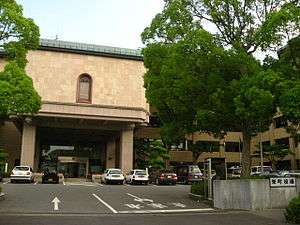
Sakae Town Office | |||
| |||
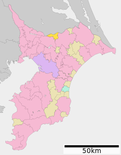
 Location of Sakae in Chiba Prefecture | |||
 Sakae
| |||
| Coordinates: 35°50′N 140°15′E / 35.833°N 140.250°ECoordinates: 35°50′N 140°15′E / 35.833°N 140.250°E | |||
| Country | Japan | ||
| Region | Kantō | ||
| Prefecture | Chiba Prefecture | ||
| District | Inba | ||
| Area | |||
| • Total | 32.46 km2 (12.53 sq mi) | ||
| Population (April 2012) | |||
| • Total | 21,961 | ||
| • Density | 677/km2 (1,750/sq mi) | ||
| Time zone | Japan Standard Time (UTC+9) | ||
| - Tree | Camellia sasanqua | ||
| - Flower | Gentiana scabra | ||
| Phone number | 0476-95-1111 | ||
| Address | 1-2 Ajikidai Inba-gun, Sakae-machi, Chiba-ken 270-1592 | ||
| Website | Town of Sakae | ||

Sakae (栄町 Sakae-machi) is a town located in Inba District, Chiba Prefecture, Japan. As of April 2012, the town had an estimated population of 21,961 and a population density of 677 persons per km². The total area was 32.46 km².
Geography
Sakae is located in far northern Chiba Prefecture, in the flatlands bordering the Tone River.
Neighboring municipalities
History
Sakae village was founded on April1, 1889 through the merger of seven small hamlets in Shimohabu District. On the same day, Fukama Village in Inba District was founded through the merger of 15 small hamlets. On December 28, 1892, Sakae Village was promoted to town status and renamed Ajiki Town. On April 1, 1897, Shimohabu District was abolished, and Ajiki Town became part of Inba District. On December 1, 1955, the town of Ajiki and the village of Fukama merged to form the new town of Sakae. In a border of adjustment on January 1, 1956, Sakae annexed a portion of neighboring Kawachi, Ibaraki to gain its current borders.
Economy
Sakae is a regional commercial center with light manufacturing, primarily related to the food processing industries.
Transportation
Railway
Highway
Local attractions
- Ryukaku-ji - Buddhist temple founded in the Nara period, containing numerous Kofun period burial mounds
Notable people from Sakae
- Masafumi Togano - professional baseball player
External links
- Sakae official website in Japanese
- English homepage on official website
