Melbourne, Quebec
For the former village of Melbourne (now part of Richmond), see Richmond, Quebec.
| Melbourne | |
|---|---|
| Township municipality | |
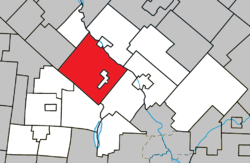
 Location within Le Val-Saint-François RCM. | |
 Melbourne Location in southern Quebec. | |
| Coordinates: 45°35′N 72°10′W / 45.583°N 72.167°WCoordinates: 45°35′N 72°10′W / 45.583°N 72.167°W[1] | |
| Country |
|
| Province |
|
| Region | Estrie |
| RCM | Le Val-Saint-François |
| Constituted | July 1, 1855 |
| Government[2] | |
| • Mayor | James Johnston |
| • Federal riding | Richmond—Arthabaska |
| • Prov. riding | Richmond |
| Area[2][3] | |
| • Total | 173.70 km2 (67.07 sq mi) |
| • Land | 174.34 km2 (67.31 sq mi) |
| There is an apparent contradiction between two authoritative sources | |
| Population (2011)[3] | |
| • Total | 1,004 |
| • Density | 5.8/km2 (15/sq mi) |
| • Pop 2006-2011 |
|
| • Dwellings | 488 |
| Time zone | EST (UTC−5) |
| • Summer (DST) | EDT (UTC−4) |
| Postal code(s) | J0B 2B0 |
| Area code(s) | 819 |
| Highways |
|
| Website |
www |
Melbourne is a township municipality located in Le Val-Saint-François Regional County Municipality in the Estrie region of Quebec.
Demographics
Population
| Historical Census Data - Melbourne, Quebec[4] | ||||||||||||||||||||||||||
|---|---|---|---|---|---|---|---|---|---|---|---|---|---|---|---|---|---|---|---|---|---|---|---|---|---|---|
|
|
| ||||||||||||||||||||||||
Language
Mother tongue (2011)[3]
| Language | Population | Pct (%) |
|---|---|---|
| French only | 690 | 68.0% |
| English only | 280 | 27.6% |
| English and French | 15 | 1.5% |
| Non-official languages | 15 | 1.5% |
| French and non-official language | 5 | 0.5% |
| English and non-official language | 5 | 0.5% |
| English, French and non-official language | 5 | 0.5% |
See also
References
- ↑ Reference number 40419 of the Commission de toponymie du Québec (French)
- 1 2 Geographic code 42075 in the official Répertoire des municipalités (French)
- 1 2 3 "(Code 2442075) Census Profile". 2011 census. Statistics Canada. 2012.
- ↑ Statistics Canada: 1996, 2001, 2006, 2011 census
External links
- Canton de Melbourne (in French)
 |
Ulverton | Cleveland Richmond |
 | |
| Durham-Sud Maricourt |
|
Val-Joli Saint-François-Xavier-de-Brompton | ||
| ||||
| | ||||
| Racine |

This article is issued from Wikipedia - version of the 4/12/2014. The text is available under the Creative Commons Attribution/Share Alike but additional terms may apply for the media files.