Mariveles, Bataan
| Mariveles | |
|---|---|
| Municipality | |
|
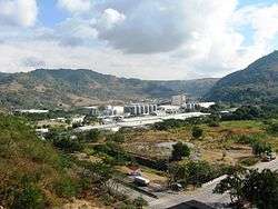
Mariveles seen from Manila Bay | |
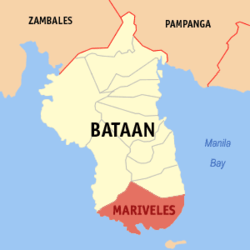
 Location within Bataan province | |
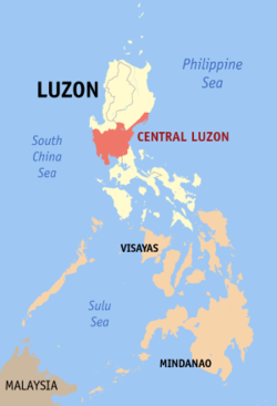
.svg.png) Mariveles Location within the Philippines | |
| Coordinates: 14°26′N 120°29′E / 14.43°N 120.48°ECoordinates: 14°26′N 120°29′E / 14.43°N 120.48°E | |
| Country | Philippines |
| Region | Central Luzon (Region III) |
| Province | Bataan |
| District | 2nd District |
| Founded | 1754 |
| Barangays | 18 (see Barangays) |
| Government [1] | |
| • Type | Sangguniang Bayan |
| • Mayor | Ace Jello C. Concepcion (National Unity) |
| • Vice Mayor | Angelito S. Rubia (National Unity) |
| Area[2] | |
| • Total | 153.9 km2 (59.4 sq mi) |
| Population (2015 census)[3] | |
| • Total | 127,536 |
| • Density | 830/km2 (2,100/sq mi) |
| • Voter (2016)[4] | 75,890 |
| Time zone | PST (UTC+8) |
| ZIP code | 2105 |
| IDD : area code | +63 (0)47 |
| Income class | 1st class |
| PSGC | 030807000 |
| Website |
marivelesbataan |
Mariveles, officially the Municipality of Mariveles (Filipino: Bayan ng Mariveles), is a municipality in the province of Bataan in the Central Luzon (Region III) of the Philippines. The population was 127,536 at the 2015 census.[3] In the 2016 election, it had 75,890 registered voters.[4]
History
Founded as a pueblo by a Franciscan Friar in 1578, Mariveles, the "Village of Kamaya" was part of the Corregimiento of Mariveles, including Bagac and Morong, Corregidor and Maragondon, Cavite.
The Superior Decree of July 1754 declared Mariveles' independence from Pampanga.
In the 19th century, the Americans established the first quarantine station in the old Spanish Leprosarium Hospital (now, the Mariveles Mental Ward).
Geography
Mariveles is located at 14°26′N 120°29′E / 14.43°N 120.48°E in a cove at the southern tip of the Bataan Peninsula. It is 164 kilometres (102 mi) from Manila via the North Luzon Expressway, Gapan-Olongapo Road and Roman Highway.
According to the Philippine Statistics Authority, the municipality has a land area of 153.9 square kilometres (59.4 sq mi)[2] constituting 11.21% of the 1,372.98-square-kilometre- (530.11 sq mi) total area of Bataan. Of this, about 69% consist of the pastureland, 19% of forestland, 6% agricultural lands and the remaining 6% for residential and industrial use.
Barangays
Mariveles is politically subdivided into 18 barangays.[5]
| PSGC | Barangay | Population | ±% p.a. | ||
|---|---|---|---|---|---|
| 2015[3] | 2010[6] | ||||
| 030807001 | Alas‑asin | 11.8% | 15,047 | 11,606 | +5.07% |
| 030807002 | Alion | 2.6% | 3,264 | 3,015 | +1.52% |
| 030807013 | Balon‑Anito | 9.6% | 12,286 | 10,255 | +3.50% |
| 030807006 | Baseco Country (Nassco) | 3.6% | 4,581 | 3,440 | +5.61% |
| 030807003 | Batangas II | 4.7% | 5,951 | 5,122 | +2.90% |
| 030807014 | Biaan | 1.4% | 1,837 | 1,571 | +3.02% |
| 030807004 | Cabcaben | 5.0% | 6,427 | 6,269 | +0.48% |
| 030807015 | Camaya | 11.7% | 14,869 | 12,077 | +4.04% |
| 030807016 | Ipag | 7.8% | 10,010 | 9,430 | +1.14% |
| 030807005 | Lucanin | 4.1% | 5,169 | 3,570 | +7.30% |
| 030807017 | Malaya | 3.8% | 4,910 | 5,211 | −1.13% |
| 030807018 | Maligaya | 3.5% | 4,407 | 4,416 | −0.04% |
| 030807019 | Mt. View | 8.2% | 10,461 | 8,843 | +3.25% |
| 030807008 | Poblacion | 6.2% | 7,938 | 8,074 | −0.32% |
| 030807009 | San Carlos | 1.2% | 1,517 | 1,592 | −0.91% |
| 030807010 | San Isidro | 4.5% | 5,761 | 5,816 | −0.18% |
| 030807011 | Sisiman | 4.9% | 6,221 | 5,837 | +1.22% |
| 030807020 | Townsite | 5.4% | 6,880 | 6,563 | +0.90% |
| Total | 127,536 | 112,707 | +2.38% | ||
Demographics
| Population census of Mariveles | |||||||||||||||||||||||||
|---|---|---|---|---|---|---|---|---|---|---|---|---|---|---|---|---|---|---|---|---|---|---|---|---|---|
|
| ||||||||||||||||||||||||
| Source: PSA[3][6][7] | |||||||||||||||||||||||||
In the 2015 census, Mariveles had a population of 127,536.[3] The population density was 830 inhabitants per square kilometre (2,100/sq mi).
In the 2016 election, it had 75,890 registered voters.[4]
Mariveles is home to an Aeta community speaking a Sambalic language called Mariveleño.
Government
Pursuant to the Local government in the Philippines",[8][9] the political seat of the municipal government is located at the Municipal Hall. In the History of the Philippines (1521–1898), the Gobernadorcillo is the Chief Executive who held office in the Presidencia. During the American rule (1898–1946) (History of the Philippines (1898-1946)), the elected Mayor and local officials, including the appointed ones held office at the Municipal Hall. The legislative and executive departments perform their functions in the Sangguniang Bayan (Session Hall) and Municipal Trial Court, respectively, and are located in the second floor of the Town Hall and in the adjacent building.
The Municipal Mayor as of the 2016 national and provincial elections, serving his 1st term in office is Ace Jello "AJ" C. Concepcion.
The Sangguniang Bayan Members are: + Chairman and Vice-Mayor: Angelito S. Rubia
- Councilors: Jaja P. Castañeda, Harry F. Golocan, Tito Pancho S. Catipon, Victoriano C. Isip, Angelito M. Sunga, Emerson Reyes, Joey Carandang, Susan Murillo, and Arvin V. Zurita (Municipal ABC President).[10]
Infrastructure
Mariveles can be reached through jet ferry plying the Mariveles to Manila route that has an approximate travel time of 40 minutes. The Bataan Provincial Expressway, also called Roman Super-Highway, is a limited-access toll expressway that connects Bataan to the provinces of the Central Luzon region in the Philippines. Mariveles is off Exit 55.
Education
Tertiary educational institutions include:
- Polytechnic University of the Philippines (PUP), a state university that offers baccalaureate (college) degrees where students are scholars of the government (after passing an entrance exam). Opened in 1976, the campus is located within the Freeport Area of Bataan.
- Maritime Academy of Asia and the Pacific (MAAP) located at Kamaya Point, Barangay Alas-asin, offering courses in the maritime industry. Students are accepted after passing stringent academic and physical examinations.
- TESDA Mariveles Bataan Branch, located at Brgy. Camaya and near the Public Market, Mariveles Municipal Hall, and Freeport Area of Bataan, offering technical and vocational courses.
- Softnet Information Technology Center (SITC) located at 2nd floor SFB #8, FAB, offering associate degrees in computer studies.
Attractions
Mariveles' attractions, events and historical landmarks include:

.jpg)
- Freeport Area of Bataan: Freeport Area of Bataan Admin Building - 1,700-hectare freeport in Mariveles.[11] The 1,691-hectare industrial complex in Mariveles town enjoy business advantages that include tax incentives, natural endowments, and excellent leadership, under AFAB Chairman Deogracias Custodio.[12] It is the only freeport in the country with a 10.9 million cubic meter-capacity dam that delivers 14 million gallons of water every day. It is complemented by water treatment and sewerage treatment plants which employ a sustainable waste water solution.
- Mariveles geothermal area in Bataan: a geothermal area situated along the West Luzon Volcanic Arc.[13]
- GN Power Mariveles Coal Plant (GMCP), Alas-asin: 600-megawatt coal-fired power plant ($155 million was purchased by Conglomerate Ayala Corp. in December 2012).[14]
- Mount Mariveles
- Herma Shipyard Inc.
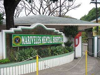
- Lazareto de Mariveles: A Quarantine station established by the Spanish government in the 1850s to check and sanitize cargoes and passengers entering Manila. The Americans, upon their conquest of the Philippines, used the same system in their ports.[15][16] The ruins of the old facility can be found inside the Mariveles Mental Hospital compound in downtown Mariveles.
- Parish Church of Saint Nicholas Tolentine: The 1729 Parish Church of Saint Nicholas Tolentine (Cath.: 36,282 Titular: St. Nicholas Tolentine, Feast day, September 10, Vicariate of Saint Michael Archangel) belongs to the Roman Catholic Diocese of Balanga[17][18][19][20][21] On September 9, 2005, Mariveles celebrated the 276th year anniversary of Apo Kolas, the Patron Saint of Mariveles — San Nicolas de Tolentino, who arrived in this town through the Order of Augustinian Recoletos missionaries. Thus, the parish was founded in 1729 bearing the name of the saint.[22]
Gallery
|
See also
- Mariveles Naval Section Base
- Bataan Peninsula
- Roman Catholic Diocese of Balanga
- Bataan Provincial Expressway
References
- ↑ "Municipality". Quezon City, Philippines: Department of the Interior and Local Government. Retrieved 31 May 2013.
- 1 2 "Province: Bataan". PSGC Interactive. Makati City, Philippines: Philippine Statistics Authority. Retrieved 21 November 2016.
- 1 2 3 4 5 "Region III (CENTRAL LUZON)". Census of Population (2015): Total Population by Province, City, Municipality and Barangay (Report). PSA. Retrieved 20 June 2016.
- 1 2 3 "2016 National and Local Elections Statistics". Commission on Elections. 2016.
- ↑ "Municipal: Mariveles, Bataan". PSA. Philippines: National Statistical Coordination Board. Retrieved 8 January 2016.
- 1 2 "Region III (CENTRAL LUZON)". Census of Population and Housing (2010): Total Population by Province, City, Municipality and Barangay (Report). NSO. Retrieved 29 June 2016.
- ↑ "Region III (CENTRAL LUZON)". Census of Population (1995, 2000 and 2007): Total Population by Province, City and Municipality (Report). NSO. Archived from the original on 24 June 2011.
- ↑ "Philippines : Gov.Ph : About the Philippines :". www.gov.ph. Retrieved 2009-03-28.
- ↑ "The Local Government Code Of The Philippines - Chan Robles Virtual Law Library". Chanrobles.com. Retrieved 2016-11-21.
- ↑ "Mariveles - Municipal Officials". Marivelesbataan.gov.ph. 2013-12-09. Retrieved 2016-11-21.
- ↑
- ↑
- ↑ "DOE set to award 4 renewable energy contracts". Business.inquirer.net. 2013-01-06. Retrieved 2016-11-21.
- ↑ Dela, Zinnia B. (2012-12-18). "Ayala buys into Mariveles power plant". philstar.com. Retrieved 2016-11-21.
- ↑ "100 SIgnificant Events in Philippine History". The Manila Times. September 18, 2006. Retrieved 21 December 2014.
- ↑ Shellum, Brian (February 1, 2010). Black Officer in a Buffalo Soldier Regiment: The Military Career of Charles Young (1st ed.). Bison Books. p. 134. ISBN 0803213859.
- ↑ "List of Parishes of the Roman Catholic Diocese of Balanga | Philippine Churches". Church.nfo.ph. 2012-06-27. Retrieved 2016-11-21.
- ↑
- ↑ "Parishes". Cbcponline.net. Retrieved 2016-11-21.
- ↑ "NewAssignsJune6". Balangadiocese.com. 2011-06-06. Retrieved 2016-11-21.
- ↑
- ↑
External links
| Wikimedia Commons has media related to Mariveles, Bataan. |
 |
Bagac / Limay |  | ||
| South China Sea | |
Manila Bay | ||
| ||||
| | ||||
| Manila Bay Cavite City (Corregidor Island) |

