Mariginiup, Western Australia
| Mariginiup Perth, Western Australia | |||||||||||||
|---|---|---|---|---|---|---|---|---|---|---|---|---|---|
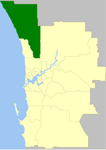
 Mariginiup Location in metropolitan Perth | |||||||||||||
| Coordinates | 31°42′43″S 115°50′13″E / 31.712°S 115.837°ECoordinates: 31°42′43″S 115°50′13″E / 31.712°S 115.837°E | ||||||||||||
| Population | 863 (2011 census) | ||||||||||||
| Postcode(s) | 6078 | ||||||||||||
| LGA(s) | City of Wanneroo | ||||||||||||
| State electorate(s) | Wanneroo | ||||||||||||
| Federal Division(s) | Pearce | ||||||||||||
| |||||||||||||
Mariginiup is an outer northern suburb of Perth, Western Australia, located within the City of Wanneroo.
This article is issued from Wikipedia - version of the 4/25/2016. The text is available under the Creative Commons Attribution/Share Alike but additional terms may apply for the media files.
