Laguna Cartagena National Wildlife Refuge
| Laguna Cartagena National Wildlife Refuge | |
|---|---|
|
IUCN category IV (habitat/species management area) | |
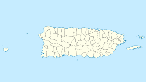
 Map of Puerto Rico | |
| Location | Lajas, Puerto Rico, Caribbean |
| Coordinates | 18°00′50″N 67°06′04″W / 18.01389°N 67.10111°WCoordinates: 18°00′50″N 67°06′04″W / 18.01389°N 67.10111°W |
| Area | 1,059 acres (4.29 km2) |
| Established | 1989 |
| Governing body | U.S. Fish and Wildlife Service |
| Website | Laguna Cartagena National Wildlife Refuge |
The Laguna Cartagena National Wildlife Refuge is a National Wildlife Refuge in Lajas, Puerto Rico. It is part of the Caribbean Islands National Wildlife Refuge Complex.
The present lagoon is a remnant of what was once a large open expanse of water and one of the most important freshwater habitats for migrating waterfowl and aquatic birds in Puerto Rico. Due to agricultural practices, about 90 percent of the lagoon is covered with cattail. Intensive cattle grazing and sugar cane production have greatly altered the original landscape.
In addition to the lagoon, there are uplands that include pastureland, abandoned sugar cane fields, and 263 acres (1.06 km2) in the foothills of the Sierra Bermeja. These hills, geologically the oldest in the Caribbean, protect native forest with many endemic plant species. The area is a stopover for neotropical migrants and several species of waterbirds. The endangered yellow-shouldered blackbird and peregrine falcon have been reported on the refuge.
References
![]() This article incorporates public domain material from websites or documents of the United States Fish and Wildlife Service.
This article incorporates public domain material from websites or documents of the United States Fish and Wildlife Service.