Cabo Rojo National Wildlife Refuge
| Cabo Rojo National Wildlife Refuge | |
|---|---|
|
IUCN category IV (habitat/species management area) | |
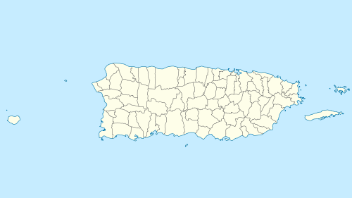
 Map of Puerto Rico | |
| Location | Cabo Rojo, Puerto Rico, Caribbean |
| Coordinates | 17°58′45″N 67°10′06″W / 17.97917°N 67.16833°WCoordinates: 17°58′45″N 67°10′06″W / 17.97917°N 67.16833°W |
| Area | 1,836 acres (7.43 km2) |
| Established | 1974 |
| Governing body | U.S. Fish and Wildlife Service |
| Website | Cabo Rojo National Wildlife Refuge |
Cabo Rojo National Wildlife Refuge is located on the southwestern side of Puerto Rico in the municipio of Cabo Rojo. It was established in 1974, when 587 acres of land were obtained by the U.S. Fish and Wildlife Service from the Central Intelligence Agency which had operated the Caribbean Bureau of the Foreign Broadcast Information Service there for a number of years. The 1,836 acres (7.43 km2) refuge is a habitat for number of native bird species including the endangered yellow-shouldered blackbird also known as la mariquita de Puerto Rico or capitán. Many birds find their way to the refuge while migrating between North and South America.
In 1999, the National Wildlife system purchased and added to the refuge the Cabo Rojo Salt Flats, an historic salt mining enterprise located near the Los Morrillos Lighthouse. Caborrojeños Pro Salud y Ambiente, a local civic group, runs a visitor's center in the salt flats. More than 118 bird species have been recorded near the area.
.jpg)
The Cabo Rojo National Wildlife Refuge is administered as part of the Caribbean Islands National Wildlife complex.
See also
