Kirov Oblast
| Kirov Oblast Кировская область (Russian) | |||
|---|---|---|---|
| — Oblast — | |||
| |||
|
| |||
| |||
|
| |||
| Political status | |||
| Country | Russia | ||
| Federal district | Volga[2] | ||
| Economic region | Volga-Vyatka[3] | ||
| Established | December 5, 1936[4] | ||
| Administrative center | Kirov | ||
| Government (as of December 2014) | |||
| • Governor[5] | Nikita Belykh[6] | ||
| • Legislature | Legislative Assembly[5] | ||
| Statistics | |||
| Area (as of the 2002 Census)[7] | |||
| • Total | 120,800 km2 (46,600 sq mi) | ||
| Area rank | 30th | ||
| Population (2010 Census)[8] | |||
| • Total | 1,341,312 | ||
| • Rank | 35th | ||
| • Density[9] | 11.1/km2 (29/sq mi) | ||
| • Urban | 74.0% | ||
| • Rural | 26.0% | ||
| Population (January 2014 est.) | |||
| • Total | 1,310,900[10] | ||
| Time zone(s) | MSK (UTC+03:00)[11] | ||
| ISO 3166-2 | RU-KIR | ||
| License plates | 43 | ||
| Official languages | Russian[12] | ||
| Official website | |||
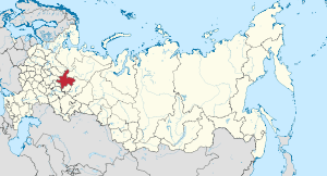
Kirov Oblast (Russian: Ки́ровская о́бласть, Kirovskaya oblast) is a federal subject of Russia (an oblast). Its administrative center is the city of Kirov. Population: 1,341,312 (2010 Census).[8]
Geography
Natural resources
The basis of the natural resources of the forest are (mostly conifers), phosphate rock, peat, furs, water and land resources. Extremely rare mineral volkonskoite. Widespread deposits of peat. Large stocks of non-metallic mineral raw materials: limestone, marl, clay, sand and gravel. In recent decades, in the east of the area revealed a minor recoverable oil reserves and deposits of bentonite clays. In the area is the largest in Europe Vyatsko-Kama deposit of phosphate rock . The area is rich in mineral springs and therapeutic mud. On the territory of Kumyonsky District is famous resort town of federal significance Nizhneivkino, which on treatment and rest come to residents of the Kirov region and many regions of Russia.
Hydrography
The region has a total length of 19753 River 66.65 kilometers. Northern Uvaly two separate river basins - the Severodvinsk and the Volga. Much of the area is occupied by the Vyatka River basin, a tributary of the Kama River in Tatarstan. At Kama is only in the upper reaches. To large flowing within the area are also river mole and Tansy, Luza, Cobra, Cheptsa.
The total number of lakes in the area of 4.5 thousand ponds With the total number of closed water area of 5.5 million. The largest lakes : Akshuben - 85 hectares, the Oryol is 63 hectares, Muserskoe - 32 hectares. The deepest area of the pond Lezhninskoe Lake - 36.6m.
History
Kirov Krai was established on December 7, 1934.[4] It was transformed into Kirov Oblast on December 5, 1936 upon the adoption of the 1936 Soviet Constitution.[4]
Administrative divisions
Kirov Oblast was formed on December 7, 1934. It is divided administratively into 39 districts, 6 cities under oblast jurisdiction, 13 town under district jurisdiction, 58 urban-type settlements, and 580 selsoviets.
Economy
Kirov Oblast is part of the Volga–Vyatka economic district located in the central part of European Russia in the Volga and Vyatka river basins. Its economic complex had already begun forming and developing before the Revolution, in large part because of the transfer points and trading posts located in Vyatka, which later led to the formation of large trading centers. Agriculture was the priority sector at first, but starting in 1940, there was an upsurge in development of an industrial complex, especially the engineering, metalworking, and chemical industries.[13]
Kirov Oblast is part of the Volga–Vyatka agricultural zone, where more than half of the area sown in grain is located in Kirov Oblast itself. Agricultural land occupies 27% of the region's territory. The most important grain crops are winter and spring wheat and rye. Barley and oats are grown for fodder. Increased specialization in the production of more promising fodder crops like winter rye, barley, oats that are most suited to the Oblast's climatic conditions is anticipated in the future. Potatoes are also extensively cultivated.[13]
Transportation
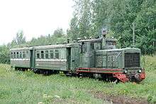
- The Dymnoye peat narrow gauge railway for hauling peat; operates in Verkhnekamsky District
- The Gorokhovskoye peat narrow gauge railway for hauling peat; operates in Kotelnichsky District
- The Otvorskoye peat narrow gauge railway for hauling peat operates in Kotelnichsky District
- The Pishchalskoye peat narrow gauge railway for hauling peat; operates in Orichevsky District
- The Kobrinskaya narrow gauge railway for hauling felled logs; operates in Murashinsky District
- The Oparinskaya narrow gauge railway for hauling felled logs; operates in Oparinsky District
Politics
During the Soviet period, the high authority in the oblast was shared between three persons: The first secretary of the Kirov CPSU Committee (who in reality had the biggest authority), the chairman of the oblast Soviet (legislative power), and the Chairman of the oblast Executive Committee (executive power). Since 1991, CPSU lost all the power, and the head of the Oblast administration, and eventually the governor was appointed/elected alongside elected regional parliament.
The Charter of Kirov Oblast is the fundamental law of the region. The Legislative Assembly of Kirov Oblast is the province's standing legislative (representative) body. The Legislative Assembly exercises its authority by passing laws, resolutions, and other legal acts and by supervising the implementation and observance of the laws and other legal acts passed by it. The highest executive body is the Oblast Government, which includes territorial executive bodies such as district administrations, committees, and commissions that facilitate development and run the day to day matters of the province. The Oblast administration supports the activities of the Governor who is the highest official and acts as guarantor of the observance of the oblast Charter in accordance with the Constitution of Russia.
Demographics
Population: 1,341,312 (2010 Census);[8] 1,503,529 (2002 Census);[14] 1,692,655 (1989 Census).[15]
- 2007
- Birth Rate: 10.6 per 1000 in 2007
- Death Rate: 16.8 per 1000 in 2007[16]
- 2008
- Births (2008): 15,906 (11.3 per 1000)
- Deaths (2008): 24,081 (17.1 per 1000)[17]
- Vital statistics for 2012
2009 - 1.59 | 2010 - 1.59 | 2011 - 1.64 | 2012 - 1.81 | 2013 - 1.87 | 2014 - 1.89 | 2015 - 1.90(e)
- 2010
Ethnic Composition (2010):[8]
- Russians - 91.9%
- Tatars - 2.8%
- Mari people - 2.3%
- Udmurts - 1%
- Ukrainians - 0.6%
- Others - 1.4%
- 35,385 people were registered from administrative databases, and could not declare an ethnicity. It is estimated that the proportion of ethnicities in this group is the same as that of the declared group.[20]
Religion
According to a 2012 official survey[21] 40.1% of the population of Kirov Oblast adheres to the Russian Orthodox Church, 5% are unaffiliated generic Christians, 1% are Orthodox Christian believers not belonging to churches or members of non-Russian Orthodox churches, 1% are adherents to Islam, 1% to the Old Believers. In addition, 33% of the population deems itself to be "spiritual but not religious", 13% is atheist, and 5.9% follows other religions or did not give an answer to the question.[21]
See also
References
| Wikivoyage has a travel guide for Kirov Oblast. |
| Wikimedia Commons has media related to Kirov Oblast. |
Notes
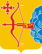
- ↑ Article 17 of the Charter of Kirov Oblast does not specify any symbols of the oblast other than a flag and a coat of arms
- ↑ Президент Российской Федерации. Указ №849 от 13 мая 2000 г. «О полномочном представителе Президента Российской Федерации в федеральном округе». Вступил в силу 13 мая 2000 г. Опубликован: "Собрание законодательства РФ", №20, ст. 2112, 15 мая 2000 г. (President of the Russian Federation. Decree #849 of May 13, 2000 On the Plenipotentiary Representative of the President of the Russian Federation in a Federal District. Effective as of May 13, 2000.).
- ↑ Госстандарт Российской Федерации. №ОК 024-95 27 декабря 1995 г. «Общероссийский классификатор экономических регионов. 2. Экономические районы», в ред. Изменения №5/2001 ОКЭР. (Gosstandart of the Russian Federation. #OK 024-95 December 27, 1995 Russian Classification of Economic Regions. 2. Economic Regions, as amended by the Amendment #5/2001 OKER. ).
- 1 2 3 Administrative-Territorial Structure of the Union Republics. 1987., p. 155
- 1 2 Charter, Article 3
- ↑ Official website of the Government of Kirov Oblast. Governor of Kirov Oblast
- ↑ Федеральная служба государственной статистики (Federal State Statistics Service) (2004-05-21). "Территория, число районов, населённых пунктов и сельских администраций по субъектам Российской Федерации (Territory, Number of Districts, Inhabited Localities, and Rural Administration by Federal Subjects of the Russian Federation)". Всероссийская перепись населения 2002 года (All-Russia Population Census of 2002) (in Russian). Federal State Statistics Service. Retrieved 2011-11-01.
- 1 2 3 4 Russian Federal State Statistics Service (2011). "Всероссийская перепись населения 2010 года. Том 1" [2010 All-Russian Population Census, vol. 1]. Всероссийская перепись населения 2010 года (2010 All-Russia Population Census) (in Russian). Federal State Statistics Service. Retrieved June 29, 2012.
- ↑ The density value was calculated by dividing the population reported by the 2010 Census by the area shown in the "Area" field. Please note that this value may not be accurate as the area specified in the infobox is not necessarily reported for the same year as the population.
- ↑ Kirov Oblast Territorial Branch of the Federal State Statistics Service. Оценка численности населения Кировской области на начало года (Russian)
- ↑ Правительство Российской Федерации. Федеральный закон №107-ФЗ от 3 июня 2011 г. «Об исчислении времени», в ред. Федерального закона №271-ФЗ от 03 июля 2016 г. «О внесении изменений в Федеральный закон "Об исчислении времени"». Вступил в силу по истечении шестидесяти дней после дня официального опубликования (6 августа 2011 г.). Опубликован: "Российская газета", №120, 6 июня 2011 г. (Government of the Russian Federation. Federal Law #107-FZ of June 31, 2011 On Calculating Time, as amended by the Federal Law #271-FZ of July 03, 2016 On Amending Federal Law "On Calculating Time". Effective as of after sixty days following the day of the official publication.).
- ↑ Official on the whole territory of Russia according to Article 68.1 of the Constitution of Russia.
- 1 2 Kirov Region
- ↑ Russian Federal State Statistics Service (May 21, 2004). "Численность населения России, субъектов Российской Федерации в составе федеральных округов, районов, городских поселений, сельских населённых пунктов – районных центров и сельских населённых пунктов с населением 3 тысячи и более человек" [Population of Russia, Its Federal Districts, Federal Subjects, Districts, Urban Localities, Rural Localities—Administrative Centers, and Rural Localities with Population of Over 3,000] (XLS). Всероссийская перепись населения 2002 года [All-Russia Population Census of 2002] (in Russian). Retrieved August 9, 2014.
- ↑ Demoscope Weekly (1989). "Всесоюзная перепись населения 1989 г. Численность наличного населения союзных и автономных республик, автономных областей и округов, краёв, областей, районов, городских поселений и сёл-райцентров" [All Union Population Census of 1989: Present Population of Union and Autonomous Republics, Autonomous Oblasts and Okrugs, Krais, Oblasts, Districts, Urban Settlements, and Villages Serving as District Administrative Centers]. Всесоюзная перепись населения 1989 года [All-Union Population Census of 1989] (in Russian). Институт демографии Национального исследовательского университета: Высшая школа экономики [Institute of Demography at the National Research University: Higher School of Economics]. Retrieved August 9, 2014.
- ↑
- ↑
- ↑ http://www.gks.ru/free_doc/2012/demo/edn12-12.htm
- ↑ http://www.gks.ru/wps/wcm/connect/rosstat_main/rosstat/ru/statistics/publications/catalog/doc_1137674209312
- ↑ http://www.perepis-2010.ru/news/detail.php?ID=6936
- 1 2 3 Arena - Atlas of Religions and Nationalities in Russia. Sreda.org
- ↑ 2012 Survey Maps. "Ogonek", № 34 (5243), 27/08/2012. Retrieved September 24, 2012.
Sources
- Кировская областная Дума. №12-ЗО 27 марта 1996 г. «Устав Кировской области», в ред. Закона №537-ЗО от 28 мая 2015 г. «О внесении поправки в Устав Кировской области и внесении изменения в статью 26.1 Закона Кировской области "О Законодательном Собрании Кировской области"». Вступил в силу по истечении десяти дней со дня официального публикования (19 апреля 1996 г.), за исключением отдельных положений. Опубликован: "Вятский край", №66 (1314), 9 апреля 1996 г. (Kirov Oblast Duma. #12-ZO March 27, 1996 Charter of Kirov Oblast, as amended by the Law #537-ZO of May 28, 2015 On Amending the Charter of Kirov Oblast and Amending Article 26.1 of the Law of Kirov Oblast "On the Legislative Assembly of Kirov Oblast". Effective as of the date which is ten days after the official publication date (April 19, 1996), with the exception of several clauses.).
- "СССР. Административно-территориальное деление союзных республик. 1987." (USSR. Administrative-Territorial Structure of the Union Republics. 1987) / Составители В. А. Дударев, Н. А. Евсеева. — М.: Изд-во «Известия Советов народных депутатов СССР», 1987. — 673 с.
 |
|
|
|
 |
| |
|
| ||
| ||||
| | ||||
| |
|
|


_1.jpg)
