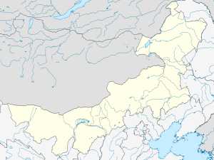
Jalaid Banner
| Jalaid Banner 扎赉特旗 • ᠵᠠᠯᠠᠢᠳᠬᠣᠰᠢᠭᠤ | |
|---|---|
| Banner | |
 Jalaid Location in Inner Mongolia | |
| Coordinates: 46°43′N 122°54′E / 46.717°N 122.900°ECoordinates: 46°43′N 122°54′E / 46.717°N 122.900°E | |
| Country | People's Republic of China |
| Region | Inner Mongolia |
| League | Hinggan League |
| Area | |
| • Total | 11,000 km2 (4,000 sq mi) |
| Elevation | 192 m (630 ft) |
| Population | |
| • Total | 400,000 |
| • Density | 36/km2 (94/sq mi) |
| Time zone | China Standard Time (UTC+8) |
| Postal code | 137600 |
| Area code(s) | 0482 |
| Website | http://www.zlt.gov.cn/ |
Jalaid Banner, officially Jalaid Qi (Mongolian: ᠵᠠᠯᠠᠢᠳ ᠬᠣᠰᠢᠭᠤ Жалаид қосиу Jalaid qosiɣu; simplified Chinese: 扎赉特旗; traditional Chinese: 紮賚特旗; pinyin: Zālàitè Qí) Zhalaite Banner, Hinggan League is a banner under the jurisdiction of Hinggan League in the northeast of the Inner Mongolia Autonomous Region, People's Republic of China. Jalaid Mongols live here.
Administration
Jalaid has jurisdiction over 7 towns and 8 villages. The administrative center is Inder (音德尔镇).
Geography
Jalaid is surrounded by the Shenshan Mountains.
Economy
Major economic sectors include timber production, sheep farming, cereal crops and livestock export.
Town twinning
It has had a formal friendship link with Portsmouth, England since May 2004.[1]
References
- ↑ Portsmouth City Council. "Zha Lai Te Qi, China China: Friendship Link with Portsmouth since 2004". Retrieved 2009-01-05.
External links
- Jalaid Banner - official website
This article is issued from Wikipedia - version of the 5/27/2016. The text is available under the Creative Commons Attribution/Share Alike but additional terms may apply for the media files.