Horqin Left Back Banner
| Horqin Left Back Banner 科尔沁左翼后旗 • ᠬᠣᠷᠴᠢᠨᠵᠡᠭᠦᠨᠭᠠᠷᠤᠨᠬᠣᠶᠢᠲᠤᠬᠣᠰᠢᠭᠤ | |
|---|---|
| County | |
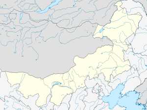
 Horqin ZYHQ Location in Inner Mongolia | |
| Coordinates: 42°57′N 122°21′E / 42.950°N 122.350°ECoordinates: 42°57′N 122°21′E / 42.950°N 122.350°E | |
| Country | People's Republic of China |
| Region | Inner Mongolia |
| Prefecture-level city | Tongliao |
| Elevation | 250 m (820 ft) |
| Time zone | China Standard (UTC+8) |
Horqin Left Back Banner (Mongolian: ᠬᠣᠷᠴᠢᠨ ᠵᠡᠭᠦᠨ ᠭᠠᠷᠤᠨ ᠬᠣᠶᠢᠲᠤ ᠬᠣᠰᠢᠭᠤ Қорчин Жэгүн арун Қоыиту қосиу Qorčin Jegün Ɣarun Qoyitu qosiɣu; Mongolian: Qorcin jegün garun qoyidu qosigu 'Northern banner of the Khorchin east wing'; simplified Chinese: 科尔沁左翼后旗; traditional Chinese: 科爾沁左翼後旗; pinyin: Kē'ěrqìn Zuǒyì Hòuqí, original Mongolian name Büve vang qosigu) is a banner of southeastern Inner Mongolia, People's Republic of China, bordering Liaoning province to the south. It is under the administration of Tongliao City, 75 kilometres (47 mi) to the north. The local Mongolian dialect is Khorchin Mongolian.
References
- www.xzqh.org (Chinese)
This article is issued from Wikipedia - version of the 5/27/2016. The text is available under the Creative Commons Attribution/Share Alike but additional terms may apply for the media files.