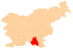
Gornje Ložine
| Gornje Ložine | |
|---|---|
 Gornje Ložine Location in Slovenia | |
| Coordinates: 45°41′32.51″N 14°48′1.17″E / 45.6923639°N 14.8003250°ECoordinates: 45°41′32.51″N 14°48′1.17″E / 45.6923639°N 14.8003250°E | |
| Country |
|
| Traditional region | Lower Carniola |
| Statistical region | Southeast Slovenia |
| Municipality | Kočevje |
| Area | |
| • Total | 6.68 km2 (2.58 sq mi) |
| Elevation | 476.3 m (1,562.7 ft) |
| Population (2002) | |
| • Total | 119 |
| [1] | |
Gornje Ložine (pronounced [ˈɡoːɾnjɛ lɔˈʒiːnɛ]; in older sources also Gorenje Ložine,[2] German: Oberloschin[2][3]) is a settlement northeast of Kočevje in southern Slovenia. The area is part of the traditional region of Lower Carniola and is now included in the Southeast Slovenia Statistical Region.[4] The settlement includes the site of the former hamlet of Schweinberg[2] at the foot of Jasnica Hill (German: Schweinberg),[5] now occupied by the abandoned Jasnica Recreation and Tourism Center.[6]
History
The Ložine volunteer fire department became a founding unit of the Kočevje municipal fire department on 28 August 1955.[7]
Church
The local church is dedicated to Saints Peter and Paul and belongs to the Parish of Stara Cerkev. It is a 15th-century late Gothic building that was refurbished in the 19th century. The main altar dates to 1861.[8]
References
- ↑ Statistical Office of the Republic of Slovenia
- 1 2 3 Leksikon občin kraljestev in dežel zastopanih v državnem zboru, vol. 6: Kranjsko. 1906. Vienna: C. Kr. Dvorna in Državna Tiskarna, pp. 42–43.
- ↑ Ferenc, Mitja. 2007. Nekdanji nemški jezikovni otok na kočevskem. Kočevje: Pokrajinski muzej, p. 4.
- ↑ Kočevje municipal site
- ↑ Laas und Čabar (map, 1:75,000). 1903. Vienna: K.u.k. Militärgeographisches Institut.
- ↑ "Rekreacijsko turistični center Jasnica prepuščen propadu." 2010. (Slovene)
- ↑ Gasilska zveza Kočevja: Zgodovina (Slovene)
- ↑ Slovenian Ministry of Culture register of national heritage reference number ešd 2300
