Fraser, Australian Capital Territory
| Fraser Canberra, Australian Capital Territory | |||||||||||||
|---|---|---|---|---|---|---|---|---|---|---|---|---|---|
 | |||||||||||||
| Population | 2,121 (2011 census)[1] | ||||||||||||
| • Density | 848/km2 (2,200/sq mi) | ||||||||||||
| Established | 1975 | ||||||||||||
| Postcode(s) | 2615 | ||||||||||||
| Area | 2.5 km2 (1.0 sq mi) | ||||||||||||
| District | Belconnen | ||||||||||||
| Territory electorate(s) | Ginninderra | ||||||||||||
| Federal Division(s) | Fenner | ||||||||||||
| |||||||||||||
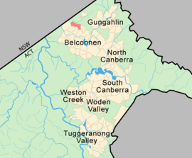
Fraser is a suburb in the Belconnen district of Canberra, located within the Australian Capital Territory, Australia. Fraser lies at the north west end of Belconnen.
The suburb is named after James Reay Fraser, who was Member of the Australian House of Representatives for the Division of Australian Capital Territory from 1951 to 1970 and Vice Chairman of the Joint Committee of the Australian Capital Territory from 1959 to 1970. It was gazetted on 15 January 1974. Streets are named after early residents of Canberra.[2]
Mount Rogers reserve is part of Fraser with an elevation of 704 metres (2,310 ft). Fraser has a neighbourhood oval and primary school. It is bordered to the north by Kuringa Drive.
In 2011, the median house price for the suburb of Fraser was A$410,000.[3]
Political representation
For the purposes of Australian federal elections for the House of Representatives, Fraser is in the Fenner.[4]
For the purposes of Australian Capital Territory elections for the ACT Legislative Assembly, Fraser is in the Ginninderra electorate.[5]
Geology
Silurian age Hawkins Volcanics green-grey dacite and quartz andesite fill the underground parts of the suburb.[6]
Educational institutions
Fraser Primary School is a local government primary school. It offers education for students from preschool to year 6.
References
- ↑ Australian Bureau of Statistics (31 October 2012). "Fraser (State Suburb)". 2011 Census QuickStats. Retrieved 21 June 2012.
- ↑ "Suburb Name search results". ACT Environment and Sustainable Development. Retrieved 11 January 2013.
- ↑ http://www.allhomes.com.au/ah/act/property-research/fraser/121462610
- ↑ "Profile of the electoral division of Fenner (ACT)". Current federal electoral divisions. Australian Electoral Commission. 8 February 2016. Retrieved 29 May 2016.
- ↑ "Electorates 2012 election". Electorates. ACT Electoral Commission. 5 July 2012. Retrieved 17 December 2013.
- ↑ Henderson G A M and Matveev G, Geology of Canberra, Queanbeyan and Environs 1:50000 1980.
Coordinates: 35°11′33″S 149°03′02″E / 35.19250°S 149.05056°E