Fort Ancient (Lebanon, Ohio)
Coordinates: 39°24′28.02″N 84°05′24.91″W / 39.4077833°N 84.0902528°W
|
Fort Ancient | |
|
Nearly two miles of trails wind through Fort Ancient State Memorial's 764 acres (3.09 km2) | |
  | |
| Nearest city | Lebanon, Ohio |
|---|---|
| NRHP Reference # | 66000625[1] |
| Added to NRHP | October 15, 1966 |
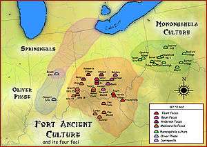
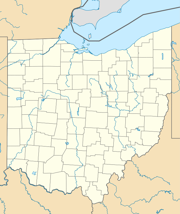
Fort Ancient (33 WA 2)[2] is a collection of Native American earthworks located in Washington Township, Warren County, Ohio, along the eastern shore of the Little Miami River about seven miles (11 km) southeast of Lebanon on State Route 350. The site is the largest prehistoric hilltop enclosure in the United States[3] with three and one-half miles (18,000 ft) of walls in a 100-acre (0.40 km2) complex. Built by the Hopewell peoples, who lived in the area from the 1st century BC to the 6th century AD, the site is situated on a wooded bluff 270 feet (82 m) above the Little Miami. It is the namesake of a culture known as Fort Ancient, who lived near the complex long after it was constructed.
Maintained as a state historical park, the site was designated a National Historic Landmark for its significance. In addition, this is part of the Hopewell Ceremonial Earthworks, one of 14 sites nominated in January 2008 by the U.S. Department of the Interior for potential submission by the United States to the UNESCO World Heritage List.[4]
Construction
The Fort Ancient earthworks were built in three stages over an estimated 400-year period. The shoulder blades of deer, split elk antlers, clam shell hoes, and digging sticks were used to loosen the dirt, and baskets holding 35 to 40 pounds were used to carry and distribute it. Archaeologists estimate the total volume of earth in the walls at 553,000 cubic yards (423,000 m3).
The site was visited and surveyed in by John Lock in 1843. In Edwin Hamilton Davis and Ephraim George Squier's Ancient Monuments of the Mississippi Valley, they described Fort Ancient as "one of the most extensive, if not the most extensive, work...in the entire West", regarding its size.[5] Warren K. Moorehead conducted some of the initial excavations at Fort Ancient in 1887 and published his research in 1891 in the book Fort Ancient: Great Prehistoric Warren County Ohio.[6]
Purpose
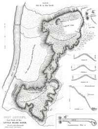
Scholars originally thought the site was created to provide shelter against enemies, but research has changed their opinion. The site presents anomalies inconsistent with defensive use:
- Ditches are located inside the walls, rather than outside as a means of defense.
- More than 60 gateways, which could not have been quickly blocked in case of attack, are present in the walls.
- Evidence has not been found for the number of occupants necessary for a significant defense force.
The prevailing scholarly opinion now is that the walls were designed for social and ceremonial purposes related to significant astronomical events. In the Northeast corner of the complex, four circular stone-covered mounds are arranged in a square. They apparently functioned as a calendar; gaps in the walls were aligned to highlight significant seasonal positions of the rising sun and moon.
In 2005 a circular arrangement of posts nearly 60 meters in diameter was discovered. At the center of the ring lies a shallow basin of burned red clay. Now known as the Moorehead Circle, research into its purpose is ongoing.[7]
The State of Ohio purchased the land and made it Ohio's first state park in 1891. It has also been designated a National Historic Landmark.
Museum
The site now includes a 9,000-square-foot (840 m2) museum covering 1500 years of American Indian heritage in the Ohio Valley. Topics include North America's earliest people, the development of agriculture, and the impact of Europeans who migrated to the area and came into conflict with its inhabitants. The Museum also contains a classroom, a research area, and a gift shop. The site is open to the public from April through October; group tours are available by appointment on a year-round basis.
Fort Ancient Village
In the 1800s to early 1900s a village existed on the eastern bank of the Little Miami River, at the base of the Fort Ancient Earthworks. The village once had a post office, hotel, blacksmith shop and other businesses and residence. The village no longer exists, but is currently the home of a canoe livery and a private campground.
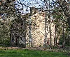
In the 19th century, Fort Ancient was a stop on the Little Miami Railroad. A historic tavern called the Cross Keys Tavern remains just across the river on the western bank and is listed on the National Register of Historic Places. The area is currently a public access to the Little Miami Bike Trail, which occupies the former railway land that follows the River. There is a public access and parking for the Little Miami River at the site.
See also
- Moorehead Circle
- List of Registered Historic Places in Warren County, Ohio
- Fort Ancient
- List of Hopewell sites
References
Footnotes
- ↑ National Park Service (2007-01-23). "National Register Information System". National Register of Historic Places. National Park Service.
- ↑ Miller, Gregory L. (2010). Ohio Hopewell Ceremonial Bladelet Use at the Moorehead Circle, Fort Ancient (PDF) (Masters thesis). Ohio State University.
- ↑ Smith, Steve; et al. (2007). "Arts & Attractions". Cincinnati USA City Guide. Cincinnati Magazine. p. 22. Retrieved 2013-05-06.
- ↑ "Secretary Kempthorne Selects New U.S. World Heritage Tentative List", Dept. of Interior (posted by Octagonmoonrise), 22 Jan 2008, accessed 5 Dec 2008
- ↑ Ephraim George Squier; Edwin Hamilton Davis (1848). Ancient Monuments of the Mississippi Valley. Smithsonian Institution. pp. 79–86.
- ↑ Moorehead, Warren K. Fort Ancient: The Great Prehistoric Earthwork 1891, AMS Press.
- ↑ "History of Fort Ancient State Memorial." Fort Ancient. Ohio Historical Society. 20 Oct 2011.
Sources
- Elva R. Adams. Warren County Revisited. [Lebanon, Ohio]: Warren County Historical Society, 1989.
- Robert L. Black. The Little Miami Railroad. Cincinnati: n.p., 1940.
- The Centennial Atlas of Warren County, Ohio. Lebanon, Ohio: The Centennial Atlas Association, 1903.
- Josiah Morrow. The History of Warren County, Ohio. Chicago: W.H. Beers, 1883. (Reprinted several times)
- Ohio Atlas & Gazetteer. 6th ed. Yarmouth, Maine: DeLorme, 2001. ISBN 0-89933-281-1
- Warren County Engineer's Office. Official Highway Map 2003. Lebanon, Ohio: The Office, 2003.
- Bradley Thomas Lepper (2005). Ohio Archaeology. Orange Frazer Press. ISBN 1-882203-39-9
- Robert P. Connolly and Bradley T. Lepper "The Fort Ancient Earthworks: Prehistoric Lifeways of the Hopewell Culture in Southwestern Ohio" Ohio Historical Society Press. (2004). ISBN 978-0877580294
External links
- Fort Ancient Archaeological Park
- Fort Ancient, Ancient Ohio Trail
- Hopewell Ceremonial Earthworks UNESCO World Heritage Nomination
- Fort Ancient Earthworks
- Article on the history of Fort Ancient Village
