Eldredge, Colorado
Coordinates: 38°17′17″N 107°46′01″W / 38.288°N 107.767°W

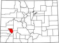
Eldredge is an unincorporated community in Ouray County, Colorado, United States.[1] The community is located between Colona and Ridgway - both within Ouray County - north of Ridgway State Park on the Colorado stretch of U.S. Route 550 and the Uncompahgre River.
Geography
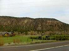
Eldredge is located within a narrow valley, of similar size to the Roaring Fork Valley. To the south of the community is the Ridgway Reservoir and Pa-co-chu-puk State Park entrance, while to the north is the Uncompahgre Valley. The community is bisected for the most part by a large, but steep hill sloping up from the Uncompahgre River and is bound to the south by Cow Creek - within the Uncompaghre River Basin - and to the north by the end of the valley.
See also
References
- ↑ "Eldredge Maps, Facts and Features". Retrieved April 9, 2011.
External links
| Wikimedia Commons has media related to Eldredge, Colorado. |
