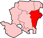
Charlwood, Hampshire
Coordinates: 51°04′45″N 1°02′13″W / 51.079181°N 1.036923°W
Charlwood is a hamlet in the East Hampshire district of Hampshire, England. It is 5 miles (8.0 km) southwest of Alton, just off the A31 road. It is in the large civil parish of Ropley.
The nearest railway station is the restored Ropley railway station on the Watercress Line, trains from which connect with the nearest national rail station 3.6 miles (5.8 km) to the northeast, at Alton.
This article is issued from Wikipedia - version of the 1/23/2016. The text is available under the Creative Commons Attribution/Share Alike but additional terms may apply for the media files.

