Bailey Road, Patna
| Bailey Road बेली रोड Jawahar Lal Nehru Marg | |
|---|---|
| Neighbourhood | |
|
| |
 Bailey Road Location in Patna, India | |
| Coordinates: 25°36′37″N 85°7′55″E / 25.61028°N 85.13194°ECoordinates: 25°36′37″N 85°7′55″E / 25.61028°N 85.13194°E | |
| Country |
India |
| State | Bihar |
| Metro | Patna |
| Languages | |
| • Spoken | Hindi, English, Magadhi |
| Time zone | IST (UTC+5:30) |
| PIN | 800014-15 |
| Planning agency | Patna Regional Development Authority |
| Civic agency | Patna Municipal Corporation |
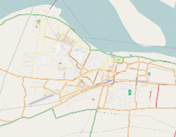
Bailey Road (Hindi: बेली रोड) is a road and neighbourhood in Patna, India.[1] It connects Patna with Danapur. It roughly starts from Income Tax Golambar and ends in Danapur, running through the heart of the city. It is one of the most important roads in the city. Many important landmarks like Patna High Court,[2] Patna Women's College, Patna Secretariat, Patna Zoo, Patna Airport etc. are situated beside or near to this road. Bailey Road was officially renamed as Jawahar Lal Nehru Marg, but this road is still widely known as Bailey Road.[3] This area is served by Shastrinagar Police Station of Patna Police.
History
Under the British Raj, Patna gradually started to attain its lost glory and emerged as an important and strategic centre of learning and trade in India. When the Bengal Presidency was partitioned in 1912 to carve out a separate province, Patna was made the capital of the new province of Bihar and Orissa.[4] The city limits were stretched westwards to accommodate the administrative base, and the township of Bankipore took shape along the Bailey Road (originally spelt as Bayley Road, after the first Lt. Governor of Bihar and Orissa, Sir Steuart Colvin Bayley). This area was called the New Capital Area.
Landmarks
- Patna Planetarium
- Income tax Office
- Mount Carmel High School, Patna
- Patna Women's College
- Eco Park
- Bihar Public Service Commission Office
- Patna Zoo
- Patna Golf Club
- Kendriya Vidyalaya, Bailey Road[5]
- IGIMS
- Paras hospital
- Delhi Public School, Patna (Junior wing)
- Bihar Museum[6]
- Ford Showroom
References
- ↑ 225 crore for renovation of 5 roads sanctioned The Times of India. Retrieved Sep 27, 2012
- ↑ Nitish Kumar opens work on Rs 530-crore museum The Times of India. Retrieved Jul 10, 2013
- ↑ "Times change, road names stay put". The Telegraph. 2 December 2013. Retrieved 27 March 2015.
- ↑ Bihar History iloveindia.com
- ↑ KV Bailey Road
- ↑ Construction of Bihar Museum at Bailey Road Patna PDF
- ↑ http://patnahighcourt.bih.nic.in/