Čierny Balog
| Čierny Balog | |
| Village | |
 Station of the Čierny Hron Railway, a narrow gauge railway | |
| Country | Slovakia |
|---|---|
| Region | Banská Bystrica |
| District | Brezno |
| Elevation | 550 m (1,804 ft) |
| Coordinates | SK 48°45′N 19°40′E / 48.750°N 19.667°ECoordinates: SK 48°45′N 19°40′E / 48.750°N 19.667°E |
| Area | 147.104 km2 (56.80 sq mi) |
| Population | 5,227 (2011[1]) |
| Density | 36/km2 (93/sq mi) |
| First mentioned | 1545 |
| Postal code | 976 52 |
| Area code | +421-48 |
| Car plate | BR |
  Location of Čierny Balog in Slovakia | |
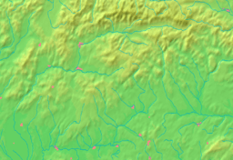
  Location of Čierny Balog in the Banská Bystrica Region | |
| Statistics: MOŠ/MIS | |
| Website: www.ciernybalog.sk | |
Čierny Balog (until 1927 also „Balog“, or „Čierny Hronec) is a municipality in Brezno District, in the Banská Bystrica Region of central Slovakia.
History
The village arose after 1882 (1888 mentioned as Feketebalog) by a merge of 13 villages (e.g. Balog, Krám, Dobroč, Dolina). It played an important role during World War II, as one of the centers of the anti-Nazi Slovak National Uprising.
See also
References
Genealogical resources
The records for genealogical research are available at the state archive "Statny Archiv in Banska Bystrica, Slovakia"
- Roman Catholic church records (births/marriages/deaths): 1656-1896 (parish A)
External links
- http://www.ciernybalog.sk
- http://www.e-obce.sk/obec/ciernybalog/cierny-balog.html
- http://www.muranskaplanina.com/ciernybalog.htm
- Surnames of living people in Cierny Balog
This article is issued from Wikipedia - version of the 2/7/2014. The text is available under the Creative Commons Attribution/Share Alike but additional terms may apply for the media files.