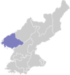
Ryongchon County
| Ryongch'ŏn County 룡천군 | |
|---|---|
| County | |
| Korean transcription(s) | |
| • Chosŏn'gŭl | 룡천군 (용천군) |
| • Hancha | 龍川郡 |
| • McCune-Reischauer | Ryongch'ŏn-gun |
| • Revised Romanization | Ryongcheon-gun (Yongcheon-gun) |
|
| |
| Country | North Korea |
| Province | North P'yŏngan |
| Administrative divisions | 1 ŭp. 3 workers' districts, 19 ri |
Ryongch'ŏn County is a kun (county) in North P'yǒngan province, North Korea, at the mouth of the Yalu River. The county seat is Ryongch'ŏn-ŭp, about 20 kilometres (12 mi) from the border with China. The area has a reported population of 27,000 and is a centre of chemical and metalworking production.
Administrative Divisions
Ryongch'ŏn county is divided into 1 ŭp (town), 3 rodongjagu (workers' districts) and 19 ri (villages):
|
|
Transport
The P'yŏngŭi line of the Korean State Railway, running between China and P'yŏngyang runs through Ryongchŏn and is served by several stations, including in Ryongch'ŏn-ŭp. It is the busiest line in the country, crossing the border in nearby Sinŭiju, North Korea to Dandong, China.
Ryongch'ŏn disaster
On 22 April 2004, the town suffered a major disaster when a flammable cargo exploded at the town's railway station, causing many deaths and much destruction, known as the Ryongch'ŏn disaster.
Protests
In February 2011, the area and others in North P'yŏngan had rare protests, of a few score of people, calling for adequate provision of rice and power. At the time, news of the Arab Spring was spreading via Chinese TV channels and phone calls with defectors.[1]
References
- ↑ Can the 'Jasmine Revolution' Spread to N.Korea?, Chosun Ilbo, 23 February 2011
See also
External links
- View disaster satellite images on Google Earth
- KoreaTimes article about the incident
- Timeline showing events in Ryongchon
- (Korean) In Korean language online encyclopedias:
Coordinates: 39°59′N 124°28′E / 39.983°N 124.467°E
