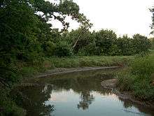
West Okaw River
| West Okaw River | |
|---|---|
 | |
| Basin | |
| Main source |
Moultrie County southwest of Hammond 39°46′57″N 88°38′11″W / 39.7825343°N 88.6364539°W |
| River mouth |
Confluence with the Kaskaskia River in Lake Shelbyville 600 ft (180 m) 39°31′42″N 88°41′41″W / 39.5283695°N 88.6947888°WCoordinates: 39°31′42″N 88°41′41″W / 39.5283695°N 88.6947888°W |
| Physical characteristics | |
| Length | 32 mi (51 km) |
| Features | |
| GNIS ID | 420878 |
The West Okaw River is a tributary of the Kaskaskia River, which it joins in Moultrie County, Illinois. The West Okaw forms an arm of Lake Shelbyville where the natural rivers used to meet.
The name "Okaw" seems to be an alternative name for the Kaskaskia River, of Native American origin. The town of Okawville is located close to the Kaskaskia, but about 100 miles downstream from the West Okaw. The Okaw Valley Council of the Boy Scouts of America is also centered on the Kaskaskia River, far downstream from the West Okaw. This may explain why there is a "West Okaw", but no "East Okaw" or "Okaw" river: the West Okaw is the western fork of the Kaskaskia, which for some reason bears the alternative name for the River.
The West Okaw is about 32 miles (51 km) in length,[1] as measured from the junction of the arms of Lake Shelbyville. This figure includes the drainage ditches, which extend the stream about eight miles above the natural channel.
The watershed of the West Okaw was formed during the Wisconsin glaciation, about 70,000 to 10,000 years before present. The Wisconsin ice sheet advanced roughly to the Lake Shelbyville Dam, forming a terminal moraine. The meltwater overtopped the moraine, forming the modern Kaskaskia River, which flowed on through land of older Illinoian Stage.
Cities, towns and counties
The following cities, towns and villages are in the West Okaw watershed:
Parts of the following Illinois counties are drained by the West Okaw:
See also
References
- ↑ U.S. Geological Survey. National Hydrography Dataset high-resolution flowline data. The National Map, accessed May 13, 2011
External links
- Fish Illinois Lake Shelbyville
- Prairie Rivers Network
- TopoQuest, West Okaw Fish and Wildlife Management Area
- USGS Real-Time Stream Gage, West Okaw at Lovington