Warrnambool Airport
| Warrnambool Airport | |||||||||||||||
|---|---|---|---|---|---|---|---|---|---|---|---|---|---|---|---|
| IATA: WMB – ICAO: YWBL | |||||||||||||||
| Summary | |||||||||||||||
| Airport type | Public | ||||||||||||||
| Owner/Operator | Warrnambool City Council | ||||||||||||||
| Location | Warrnambool, Victoria | ||||||||||||||
| Elevation AMSL | 242 ft / 74 m | ||||||||||||||
| Coordinates | 38°17′43″S 142°26′48″E / 38.29528°S 142.44667°ECoordinates: 38°17′43″S 142°26′48″E / 38.29528°S 142.44667°E | ||||||||||||||
| Map | |||||||||||||||
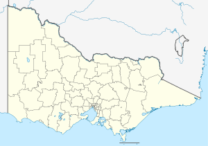
 YWBL Location in Victoria | |||||||||||||||
| Runways | |||||||||||||||
| |||||||||||||||
Warrnambool Airport (IATA: WMB, ICAO: YWBL) is located 6 nautical miles (11 km; 6.9 mi) northwest[1] of Warrnambool, Victoria in Australia. There are scenic tours offered by Air Warrnambool, as well as scheduled flights to Melbourne Essendon airport.[2] HEMS 4 (Helicopter Emergency Medical Service), a Bell 412, of Air Ambulance Victoria is based at the airport.[3]
Airlines and destinations
| Airlines | Destinations |
|---|---|
| Sharp Airlines | Melbourne–Essendon |
References
- 1 2 YWBL – Warrnambool (PDF). AIP En Route Supplement from Airservices Australia, effective 10 November 2016, Aeronautical Chart
- ↑ Air Warrnambool
- ↑ Air Ambulance Helicopters
This article is issued from Wikipedia - version of the 12/4/2016. The text is available under the Creative Commons Attribution/Share Alike but additional terms may apply for the media files.