Veluwezoom National Park
| Veluwezoom National Park | |
|---|---|
| Nationaal Park Veluwezoom | |
|
IUCN category II (national park) | |
|
Posbank (part of NP Veluwezoom) | |
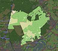
 Map of the national park | |
| Location | Gelderland, Netherlands |
| Coordinates | 52°2′N 5°57′E / 52.033°N 5.950°ECoordinates: 52°2′N 5°57′E / 52.033°N 5.950°E |
| Area | 50 km2 (19 sq mi) |
| Established | 1930[1] |
| Governing body | Natuurmonumenten |
| http://www.natuurmonumenten.nl/natmm-internet/natmm/natuurgebieden.jsp?n=35808 | |
Veluwezoom National Park is a national park located in the Dutch province of Gelderland. This park is the oldest national park of the Netherlands.[2] It is an area of 50 square kilometers at the southeastern edge of the Veluwe, a complex of terminal push moraines from the Saalian glaciation. It has a pronounced relief by Dutch standards, with the highest point in the park at 110 meters above sea level.[3] It is a private national park, owned by Vereniging Natuurmonumenten, the largest nature conservation organisation in the Netherlands.
The landscape of the park consists of forests and heathland, which is kept open by grazing of Highland cattle, and a small sand drift, which is kept open by human maintenance. The native fauna is represented by red deer, wild boar, badger and the regionally rare pine marten.
References
- ↑ (Dutch)http://www.nationaalpark.com/content/view/24/47/ Nationaalpark.com, Veluwezoom
- ↑ http://www.veluwezoom.nl/
- ↑ (Dutch) veluwezoom.nl
