Vaour
| Vaour | ||
|---|---|---|
|
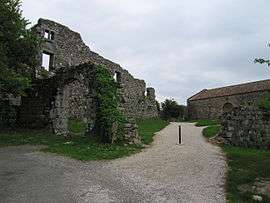
The former Commandry of Vaour | ||
| ||
 Vaour | ||
|
Location within Occitanie region  Vaour | ||
| Coordinates: 44°04′23″N 1°48′09″E / 44.0731°N 1.8025°ECoordinates: 44°04′23″N 1°48′09″E / 44.0731°N 1.8025°E | ||
| Country | France | |
| Region | Occitanie | |
| Department | Tarn | |
| Arrondissement | Albi | |
| Canton | Vaour | |
| Intercommunality | Causse Nord-Ouest du Tarn | |
| Government | ||
| • Mayor (2008–2014) | Georges Bousquet | |
| Area1 | 14.12 km2 (5.45 sq mi) | |
| Population (2006)2 | 293 | |
| • Density | 21/km2 (54/sq mi) | |
| Time zone | CET (UTC+1) | |
| • Summer (DST) | CEST (UTC+2) | |
| INSEE/Postal code | 81309 / 81140 | |
| Elevation |
240–507 m (787–1,663 ft) (avg. 432 m or 1,417 ft) | |
|
1 French Land Register data, which excludes lakes, ponds, glaciers > 1 km² (0.386 sq mi or 247 acres) and river estuaries. 2 Population without double counting: residents of multiple communes (e.g., students and military personnel) only counted once. | ||
Vaour (Vaur in Occitan) is a commune and cantonal administrative centre located in the northwestern part of the Tarn department in southern France.
On the north the commune borders the Tarn and Garonne department, and the rising land consists of a gray limestone causse stretching almost to the Averyon river seven or eight kilometers away. Below the commune to the south the landscape consists of the forest of Grésigne - the largest oak forest in the midi - its hills scattered with grassy meadows, and the vineyards of Gaillac.
Vaour contains the ruins of a Templar Commanderie which overlooks the village of Vaour and has commanding views to the South West towards the Pyrenees. The commune also hosts a performing arts festival each summer known as the Eté de Vaour which attracts visitors and performers from across France and further afield. The village hosts a market for good local produce each Thursday in the village square.
See also
References
| Wikimedia Commons has media related to Vaour. |

.svg.png)