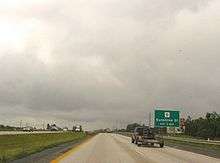
U.S. Route 65 in Missouri
| ||||
|---|---|---|---|---|
| Route information | ||||
| Maintained by MoDOT | ||||
| Length: | 313.114 mi[1] (503.908 km) | |||
| Major junctions | ||||
| South end: |
| |||
| North end: |
| |||
| Highway system | ||||
| ||||
U.S. Route 65 is a north-south U.S. highway that runs from Clayton, Louisiana to Albert Lea, Minnesota. In Missouri, the highway enters the state from Arkansas, just south of Branson. The highway exits the state into Iowa near South Lineville.
Route description

US 65 enters Missouri between Omaha, Arkansas and Ridgedale, Missouri. The road is a four-laned expressway, traveling through Branson and Hollister toward the Springfield metro area. Through the Branson area, it is built as a freeway. North of Branson, there is an interchange with Route 465 (a freeway spur) and U.S. Route 160. All the way to Highlandville, U.S. 160 is the old alignment of U.S. 65 (until the 1960s).
Just south of Route EE at the Highlandville exit, U.S. 65 returns to freeway status. The freeway is called "Schoolcraft Freeway" in Springfield, in honor of Henry Rowe Schoolcraft. In Springfield, there are junctions with U.S. Route 60 and Interstate 44. The I-44 interchange includes a flyover ramp connecting northbound U.S. 65 with westbound I-44. Construction is completed that added two at U.S. 60 (also known as the James River Freeway). In September 2011, U.S. 65 became a six-laned divided freeway in Springfield between Interstate 44 and U.S. 60. It is the first six-laned highway in Southwest Missouri.[2] North of Springfield, it returns to a four-lane, non-interstate highway.
From Springfield to Buffalo, U.S. 65 has been upgraded as a four-laned non-interstate highway. This project began with the addition of a partial four-laned highway through the Fair Grove area to replace a dangerous traffic light intersection with an overpass. It culminated with the entire length of U.S. 65 becoming a four-lanes highway from Springfield to just outside of Buffalo. It was completed in summer 2010.
Through Buffalo, the highway becomes two lanes with a center lane for left turns. This part of the highway has also seen upgrades in recent years, such as adding rumble strips and extending the middle turn lane to just outside the northern portion of the city.
From Buffalo to Preston, U.S. 65 is still a two-laned highway and has a four-way intersection with U.S. Route 54.
At Warsaw, the highway crosses over the western end of the Lake of the Ozarks and again becomes a four laned non interstate highway at the intersection with Route 7.
At Sedalia (where it is called Limit Avenue), it has an intersection with U.S. Route 50 (Broadway Blvd) and at Marshall Junction, there is one with Interstate 70 and U.S. Route 40. In Marshall, U.S. 65 is back to being a two-laned highway and stays so all the way up to Iowa. At Waverly is the beginning of a concurrency with U.S. Route 24 (which continues to Carrollton). Also in Waverly, U.S. 65 and U.S. 24 cross the Missouri River on the Waverly Bridge. Further north, the road crosses U.S. Route 36 at Chillicothe and U.S. Route 136 at Princeton. The highway leaves Missouri at South Lineville and enters Iowa.
The section of highway from Preston to Marshall Junction has been cited as a good drive for motorcyclists, with its sparsely-populated areas and the hilly landscape.[3]
History
From 1922 to 1926, US 65 in Missouri was known as Route 3. US 65 originally followed Route 248 and US 160 between Branson and Springfield. Route 3 was originally planned on a shorter route between Springfield and Preston, with Route 71 on the longer alignment via Buffalo, but Route 3 was quickly shifted east, absorbing Route 71.
Major intersections
All exits are unnumbered.
| County | Location | mi[1] | km | Destinations | Notes |
|---|---|---|---|---|---|
| Taney | Oliver Township | 0.000 | 0.000 | Continuation into Arkansas | |
| 2.807 | 4.517 | ||||
| 5.570 | 8.964 | ||||
| Hollister | 8.850 | 14.243 | |||
| Branson | 11.447 | 18.422 | |||
| 12.407 | 19.967 | Diverging diamond interchange[4] | |||
| 13.250 | 21.324 | Bee Creek Road, Branson Hills Parkway | |||
| 16.142 | 25.978 | ||||
| Jasper Township | 18.756 | 30.185 | |||
| 21.698 | 34.920 | Southern end of Route 176 overlap | |||
| 22.597 | 36.366 | Northern end of Route 176 overlap | |||
| Christian | North Galloway Township | 32.741 | 52.692 | ||
| Ozark | 37.001 | 59.547 | |||
| 38.295 | 61.630 | ||||
| 41.513 | 66.809 | ||||
| Greene | Springfield | 43.622 | 70.203 | Evans Road | |
| 45.541 | 73.291 | ||||
| 47.711 | 76.783 | Battlefield Street | |||
| 49.249 | 79.259 | ||||
| 51.274 | 82.518 | Diverging diamond interchange[5] | |||
| 52.284 | 84.143 | ||||
| 53.292 | 85.765 | ||||
| 54.079 | 87.032 | ||||
| North Campbell Township | 54.809 | 88.207 | Valley Water Mills Road (County Road 102) | Northbound exit and southbound entrance only | |
| Fair Grove | 64.869 | 104.397 | |||
| Dallas | Sheridan Township | 70.052 | 112.738 | Michigan left U-turn intersection | |
| Jackson Township | 74.162 | 119.352 | Michigan left U-turn intersection | ||
| Buffalo | 83.153 | 133.822 | |||
| 85.026 | 136.836 | ||||
| Louisburg | 91.671 | 147.530 | |||
| Hickory | Preston | 105.306 | 169.474 | ||
| Benton | Fristoe Township | 124.044 | 199.629 | Southern end of Route 7 overlap | |
| Tom Township | 128.063 | 206.097 | |||
| Warsaw | 129.688 | 208.713 | Warsaw (Main Street) | No northbound entrance | |
| 130.249 | 209.615 | Northern end of Route 7 overlap | |||
| 131.327 | 211.350 | Truman Dam Access Road | |||
| Williams Township | 146.378 | 235.573 | Southern end of Route 52 overlap | ||
| Benton–Pettis county line | Williams–Flat Creek township line | 151.426 | 243.697 | North end of Route 52 overlap | |
| Pettis | Sedalia | 163.315 | 262.830 | ||
| 163.912 | 263.791 | Northbound exit and southbound entrance only | |||
| Cedar Township | 165.752 | 266.752 | Southbound exit and northbound entrance only | ||
| Saline | Blackwater Township | 181.887 | 292.719 | ||
| Marshall | 190.141 | 306.002 | |||
| 193.242 | 310.993 | ||||
| 194.015 | 312.237 | ||||
| Grand Pass Township | 204.818 | 329.623 | |||
| Lafayette | Waverly | 211.213 | 339.914 | Southern end of US 24 overlap | |
| Carroll | Carrollton | 220.839 | 355.406 | ||
| 222.526 | 358.121 | Northern end of US 24 overlap | |||
| Livingston | Chillicothe | 253.257 | 407.578 | Southern end of US 36 Business overlap | |
| 253.359 | 407.742 | Northern end of US 36 Business overlap | |||
| 256.428 | 412.681 | ||||
| Grundy | Trenton | 276.310 | 444.678 | ||
| 277.384 | 446.406 | ||||
| Mercer | Princeton | 299.403 | 481.842 | Southern end of US 136 overlap | |
| 299.731 | 482.370 | Northern end of US 136 overlap | |||
| South Lineville | 313.114 | 503.908 | Continuation into Iowa | ||
1.000 mi = 1.609 km; 1.000 km = 0.621 mi
| |||||
See also
-
 Missouri portal
 -
 U.S. Roads portal
References
- 1 2 Missouri Department of Transportation (December 29, 2014). Flex Map Viewer (Map). Missouri Department of Transportation. Retrieved December 29, 2014.
- ↑ "MoDOT Southwest District News Release". Modot.org. 2011-08-31. Retrieved December 5, 2013.
- ↑ "US Route 65, Missouri". Motorcycle Roads.US. Retrieved December 5, 2013.
- ↑ Southwest District Office (November 20, 2011). "Route 248/Route 65 Diverging Diamond Interchange In Branson OPEN to Traffic Sunday Evening, Nov. 20" (Press release). Missouri Department of Transportation. Retrieved April 8, 2014.
- ↑ Southwest District (November 10, 2012). "Chestnut Expressway/Route 65 Interchange" (Press release). Missouri Department of Transportation. Retrieved November 10, 2012.
External links
-
 Media related to U.S. Route 65 in Missouri at Wikimedia Commons
| Previous state: Arkansas |
Missouri | Next state: Iowa |
