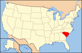
U.S. Coast Guard Historic District
|
U.S. Coast Guard Historic District | |
|
Lifesaving station and quarters, March 2015 | |
  | |
| Location | Ion Ave. between Station 18 and Station 18 1/2, Sullivan's Island, South Carolina |
|---|---|
| Coordinates | 32°45′27″N 79°50′33″W / 32.75750°N 79.84250°WCoordinates: 32°45′27″N 79°50′33″W / 32.75750°N 79.84250°W |
| Area | 5 acres (2.0 ha) |
| Built | 1919 |
| NRHP Reference # | 73001703[1] |
| Added to NRHP | June 19, 1973 |
U.S. Coast Guard Historic District is a national historic district located at Sullivan's Island, Charleston County, South Carolina. The district encompasses three contributing buildings and one contributing structure on Sullivan's Island. The property was established as a life saving station in 1891. The district contains the station house/administration building (c. 1891), boathouse (c. 1891), garage (c. 1938), and signal tower (c. 1938), which are laid out in an "L"-shaped court loosely organized around the bunker/sighting station (c. 1898). Also on the property is the non-contributing Charleston Light (ca. 1962).[2][3]
It was listed on the National Register of Historic Places in 1973.[1]
| Wikimedia Commons has media related to U.S. Coast Guard Historic District. |
References
- 1 2 National Park Service (2010-07-09). "National Register Information System". National Register of Historic Places. National Park Service.
- ↑ Elias B. Bull and Carol Stevens (January 1973). "U.S. Coast Guard Historic District" (pdf). National Register of Historic Places - Nomination and Inventory. Retrieved 2014-08-01.
- ↑ "U.S. Coast Guard Historic District, Charleston County (Ion Ave., Sullivan's Island)". National Register Properties in South Carolina. South Carolina Department of Archives and History. Retrieved 2014-08-01. and accompanying map.
This article is issued from Wikipedia - version of the 11/30/2016. The text is available under the Creative Commons Attribution/Share Alike but additional terms may apply for the media files.

