Turnbull Canyon
| Turnbull Canyon | |
|---|---|
 Turnbull Canyon from Skyline Dr. | |
| Highest point | |
| Peak | Skyline Drive |
| Elevation | 242 m (794 ft) |
| Coordinates | 33°59′35″N 118°00′51″W / 33.99306°N 118.01417°WCoordinates: 33°59′35″N 118°00′51″W / 33.99306°N 118.01417°W |
| Geography | |
 Turnbull Canyon location of Turnbull Canyon in California [1] | |
| Country | United States |
| State | California |
| District | Los Angeles County |
| Topo map | USGS Whittier, California |


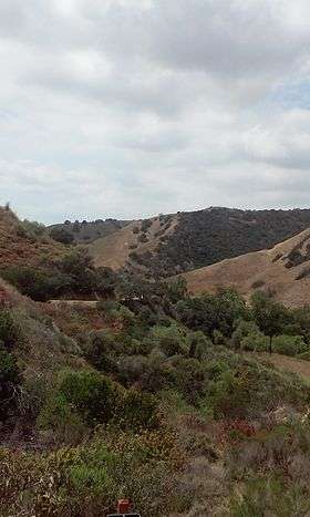
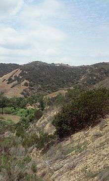
Turnbull Canyon is a 4 mile loop trail located near Whittier, California and is part of Puente Hills Preserve.[2][3] It lies in the northern-central part of the preserve, and is an east-west canyon with relatively steep drainage. The canyon has a creek at its bottom that supports a narrow strip of riparian woodland dominated by sycamore trees, while the slopes are covered in coastal sage and native and non-native grasses.[4]
Climate
The climate in Turnbull Canyon is typical of Southern California, semi-arid. Because the Whittier Hills has a relatively close proximity to the ocean, which has an equalizing effect on the climate, it is somewhat cooler here than some of the areas just south of the region. During the winter months, it is not uncommon to see frost on the ground and during summer, it rarely gets hotter than 95 degrees.[5]
Visitors
| Visitation Per Day | Percentage Hikers/Runners | Percentage Bikers | Percentage Bringing Dogs | Percentage Male | Percentage Female |
|---|---|---|---|---|---|
| 73 | 50% | 41.07% | 8.93% | 78.41% | 21.58% |
Attractions
Turnbull Canyon is known for the view it provides of the Hsi Lai Temple and Rose Hills Memorial Park. It has also been the source of rumors regarding paranormal activities [7] and was the scene of the discovery a then-missing person's body.[8]
See also
External links
| Wikimedia Commons has media related to Puente Hills. |
- Puente Hills Preserve Park Map
- Puente Hills Preserve Park - activities and homepage
- The Puente Hills Preserve: Puente - Chino Hills Wildlife Corridor
- The Puente Hills Preserve: Trails Access info.
- Puente Hills Landfill Native Habitat Preservation Authority
- Puente Hills Nature Blog (archives)
See also
- Puente Hills topics
References
- ↑ "Turnbull Canyon". Geographic Names Information System. United States Geological Survey. Retrieved 2015-04-30.
- ↑ "Trails". Puente Hills Preservation Authority. Retrieved 30 April 2015.
- ↑ "Turnbull Canyon Trail". All Trails - National Geographic. Retrieved 30 April 2015.
- ↑ "Hike Turnbull Canyon in the Puente Hills". Modern Hiker.
- ↑ Hodder, Roland F. "A Report of the Geology of a Portion of the Whittier Hills Between Turnbull and La Habra Canyons" (PDF). Caltech Thesis. Retrieved 1 May 2015.
- ↑ "Final Report - Trail Visitor User Survey - A Pilot Study of Visitation at Hellman Park and Turnbull Canyon - Whittier, California" (PDF). Habitat Authority. Retrieved 1 May 2015.
- ↑ "Turnbull Canyon Whittier/Hacienda Heights, CA". Haunted Los Angeles. 2014-08-14. Retrieved 2016-02-15.
- ↑ "Woman's body found in Turnbull Canyon". Whittier Daily News. 2011-03-03. Retrieved 2016-02-15.