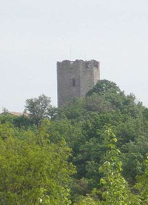
Tour de Ratières

The Tour de Ratières, built in the commune of Ratières in the north of the Drôme département of France, is a medieval tower once the keep of a castle. Approximately 15 metres high and hexagonal in plan, it overlooks the village and the surrounding plain.
History
The Tour de Ratières is a Carolingian tower protected as a monument historique since 21 October 1926 by the French Ministry of Culture.[1]
Excavations in 1993, at the time of important renovations, confirmed the existence of an earlier occupation of the site, possibly a motte-and-bailey castle.
Architecture
The castle was organised around a 14th-century octagonal keep, notable for various features designed for comfort, traces of which can be discerned on the interior walls. The present ground floor was a cellar or prison. Access to the building was made on the first floor, where there are still traces of a fireplace and chimney. The second floor has a well-preserved latrine, and the third floor has large windows which could have functioned as lookout. The coussièges (window seats) would have been occupied by those keeping a watch over the comings and goings.
The castle is perched on a hillock and dominates a lower courtyard containing:
- in the west, the "farm", a medieval two-storey building used as a stable;
- in the east, a house built in the 19th century by adding walls to the ruins of two phases on earlier construction and a barn
Garden
The castle has a garden designed by Paolo Tonini and created in 1993. Decorated with contemporary sculptures, visitors may, over an area of 5 hectares, see different gardens: an alley of rose trees, a medieval garden, rose garden, perennials garden, Italian garden.[2]
See also
References
- ↑ Ministry of Culture: Tour de Ratières (French)
- ↑ Ministry of Culture: Le Jardin de la Tour de Ratières (French)
External links
Bibliography
- I. Rémy, Etude archéologique et architecturale du site de Ratières (Drôme), Lyon, Université Lumière - Lyon 2, 1993.
- Anne et Fabian Da Costa, Châteaux de la Drôme, Ed. La Taillanderie, 2000, 64 p. (ISBN 2-87629-213-0)
Coordinates: 45°11′07″N 4°58′22″E / 45.18528°N 4.97278°E