Three Fingered Jack
| Three Fingered Jack | |
|---|---|
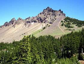
 Southwest side of Three Fingered Jack seen from Pacific Crest Trail. | |
| Highest point | |
| Elevation | 7,844 ft (2,391 m) NAVD 88[1] |
| Prominence | 2,481 ft (756 m) [2] |
| Coordinates | 44°28′44″N 121°50′35″W / 44.478965122°N 121.843058797°WCoordinates: 44°28′44″N 121°50′35″W / 44.478965122°N 121.843058797°W [1] |
| Geography | |
| Location | Jefferson and Linn counties, Oregon, U.S.[3] |
| Parent range | Cascades |
| Topo map | USGS Three Fingered Jack |
| Geology | |
| Age of rock | older than 200,000 years |
| Mountain type | Shield volcano |
| Volcanic arc | Cascade Volcanic Arc |
| Climbing | |
| First ascent | 1923 |
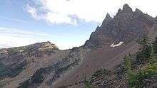
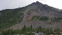
Three Fingered Jack, named for its distinctive shape, is a Pleistocene volcano in the Cascade Range of Oregon. It is a deeply glaciated shield volcano and consists mainly of basaltic andesite lava.[4] Compared with other heavily glaciated volcanic peaks such as Mount Washington and Mount Thielsen, which display eroded volcanic necks as their cores, Three Fingered Jack's present summit is a narrow ridge of loose tephra supported by a dike only 10 feet (3.0 m) thick on a generally north–south axis. Radiating dikes and plugs from a series of overlapping cinder and composite cones that support this summit have been exposed by glaciation.[5]

The sole glacier is the unofficially-named Jack glacier, located in a shaded cirque on the northeast side at an unusually low altitude for the Oregon Cascades. The last cone-building eruptions were more explosive in nature than earlier shield-building eruptions, producing mostly unconsolidated strata. Cone-building eruptions ceased before the Pleistocene glacial period, allowing the expanded glacial cover to remove most of the cone.[5]
Sources disagree about who first reached the summit; it was either six boys from Bend, Oregon,[6] or members of The Mazamas.[7] Sources agree that the ascent occurred in 1923.
Three Fingered Jack is located in the Mount Jefferson Wilderness and is not accessible by paved road, but can be approached by the Pacific Crest Trail.[8] It is regarded as extinct and has not been assessed for volcanic hazards.[5]
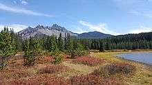
Several lakes can be found in the vicinity of Three Fingered Jack. These include Marion Lake, Mowich Lake, Duffy Lake, Santiam Lake and Wasco Lake, among others. [9]
References


- 1 2 "Three Fingered Jack=Hayrick". NGS data sheet. U.S. National Geodetic Survey. Retrieved 2008-11-17.
- ↑ "Three Fingered Jack, Oregon". Peakbagger.com. Retrieved 2008-04-02.
- ↑ "Three Fingered Jack". Geographic Names Information System. United States Geological Survey. Retrieved 2008-11-17.
- ↑ "Description: Three-Fingered Jack Volcano, Oregon". USGS Cascades Volcano Observatory. Retrieved 2008-04-01.
- 1 2 3 Harris, pp. 163–164
- ↑ Grubbs, p. 68
- ↑ Thompson, Erwin N. (March 1970). "North Cascades: Basic History Data". National Park Service. Retrieved 2008-08-08.
- ↑ Harris, p. 165
- ↑ "Three Fingered Jack". us.geoview.info. Retrieved 2016-10-03.