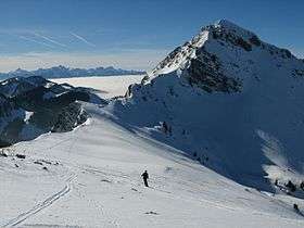
Teysachaux
| Teysachaux | |
|---|---|
 View from the north side | |
| Highest point | |
| Elevation | 1,909 m (6,263 ft) |
| Prominence | 139 m (456 ft) [1] |
| Parent peak | Moléson |
| Coordinates | 46°32′3″N 6°59′47″E / 46.53417°N 6.99639°ECoordinates: 46°32′3″N 6°59′47″E / 46.53417°N 6.99639°E |
| Geography | |
 Teysachaux Location in Switzerland | |
| Location | Fribourg, Switzerland |
| Parent range | Swiss Prealps |
Teysachaux (1,909 m) is a mountain of the Swiss Prealps, overlooking Les Paccots in the canton of Fribourg.
Toponymy
In patois, Teysachaux is the contraction of taiza ("spread") and chaux ("meadow").[2]
Geography

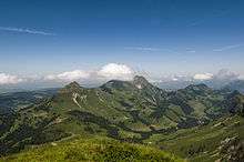
Teysachaux lies at the south end of the Moléson ridge, west of the Sarine river valley. Nearby summits include Niremont on the west side and Dent de Lys on the south side.
Several chalets (some of them have been converted into small restaurants) can be found on Teysachaux's slopes. They have been built during the 18th and 19th century, showing the evidence of a progressive expansion of farming (mainly milk and cheese) towards higher meadows.
History
In 1870, on the foothills of the west side of Teysachaux, a 2-meters long fossilised ichthyosaurus has been discovered. It dates from the Jurassic period (175 to 183 million years), when dinosaurs walked the Earth. This fossil is now part of the permanent exhibition at the Museum of Natural History of Fribourg[3]
See also
References
- ↑ Retrieved from the Swisstopo topographic maps and Google Earth
- ↑ "Noms de lieux de Suisse romande, Savoie et environs (in French)". OFEV. Retrieved 10 December 2014.
- ↑ "Musée d'Histoire Naturelle de Fribourg (in French)". OFEV. Retrieved 10 December 2014.