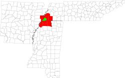
Tennessee State Route 175
| ||||
|---|---|---|---|---|
| Route information | ||||
| Maintained by TDOT | ||||
| Length: | 25 mi (40 km) | |||
| Major junctions | ||||
| West end: |
| |||
|
| ||||
| East end: |
| |||
| Location | ||||
| Counties: | Shelby | |||
| Highway system | ||||
| ||||
Tennessee State Route 175 is a Tennessee designated state route, running for a total of approximately 25 miles (40 km) through southern Shelby County, Tennessee.[1]
History
The original SR-175 was on a different route before 2004, when the last 2 miles (3.2 km) of East Shelby Drive were included into the route. The original road took a sharp left onto what is now Houston Levee Road for 0.4 miles (0.64 km), then a sharp right onto what is now Collierville Road, and continued east for 2.4 miles (3.9 km), until reaching Byhalia Road, and taking a sharp left, continuing to the end of the current route. These last 2.4 miles of SR 75 (Collierville Road) have undergone rigorous construction since about 1998, and barely one-third of the current road follows exactly the original route.
Prior to the 1980s, Shelby Drive was known as "Whitehaven-Capleville Road" or "Whitecap" for short; also, the portion of the current route between Fleming Road and Byhalia Road in Collierville was called "Mann Road."[2]
Route description
Memphis
State Route 175 begins in extreme southwestern Shelby County, Tennessee as a continuation of Mississippi 301 along Weaver Road. It intersects Highway 61 (Third Street) and travels with it until Shelby Drive where it turns east. After about 1 mile (1.6 km), SR-175 passes Greeter Park and intercepts Horn Lake Road as a crossroads, and becomes East Shelby Drive, passing through the community of Persey. SR-175 then crosses the Illinois Central Railroad. From this point, SR-175 travels another 2.4 miles through Whitehaven in southern Memphis, and intercepts U. S. Route 51 (State Route 3/Elvis Presley Boulevard). Then, SR-175 continues for 1.3 miles (2.1 km), and intercepts Interstate 55 and Interstate 69. Shortly after, intercepting Airways Boulevard and passing the Memphis International Airport. After passing the airport, SR-175 continues for another 2 miles, SR-175 then intercepts U. S. Route 78 (State Route 4/Lamar Avenue) within the community of Capleville and crosses the BNSF Railway twice.
Germantown
After 3.5 miles (5.6 km), and crossing several major city roads, SR-175 (East Shelby Drive) crosses South Germantown Road and enters Germantown, Tennessee. It then intercepts Hacks Cross Road after 1.5 miles (2.4 km).
Collierville
Following another 2 miles, SR-175 (East Shelby Drive) shares a crossroads with Forest Hill Irene Road, entering Collierville, Tennessee, and becoming a two-lane road. For the next 2 miles SR-175 is somewhat rural, then crossing South Houston Levee Road. SR-175 then briefly widens to six lanes for 0.6 miles (0.97 km) before crossing Fleming Road, and then goes another 0.5 miles (0.80 km) along a narrow rural route before stopping at Byhalia Road. SR-175 turns left onto Byhalia Road and heads nearly due north. SR-175 continues for 1 mile until widening to four lanes and crossing State Route 385. SR-175 then travels 1 mile before the designation ends at Poplar Avenue (U. S. Route 72/State Route 57) in the heart of the Collierville business district. Although State Route 175 stops here, Byhalia Road continues.[3][4]
Future
The last 0.5 miles of SR-175 on East Shelby Drive is proposed to be moved and widened to six lanes the Autumn of 2011. Also, the 0.25-mile (0.40 km) segment of SR-175 on Byhalia Road, between East Shelby Drive and SR 385 is proposed to be widened to six lanes around the same time.[5]
See also
 Tennessee portal
 U.S. Roads portal
References
- ↑ http://www.tennesseeanytime.org/maps/
- ↑ "NETR Online • Historic Aerials". Historic Aerials.
- ↑ "Google Maps". Google Maps.
- ↑ http://www.mapquest.com/maps?1c=Memphis&1s=TN&1a=[67-111]+W+Shelby+Dr&1z=38109&1y=US&1l=35.02094&1g=-90.06644&1v=BLOCK&2c=Memphis&2s=TN&2a=[110-134]+W+Shelby+Dr&2z=38109&2y=US&2l=35.02093&2g=-90.067465&2v=BLOCK#b/maps/m:map:14:35.019862:-90.083015::::::1:1:::::::::/l::W+Shelby+Dr:Memphis:TN:38109:US:35.020902:-90.068946:address:Shelby:1:::/l::4679+S+3rd+St:Memphis:TN:38109:US:35.020806:-90.087845:address:Shelby:1:::/io:1:::::f:en_US:M::/bl:/e
- ↑ "Tennessee Department of Transportation Home - TN.Gov".

