Syunik Province
| Syunik Սյունիք | |
|---|---|
| Province | |
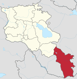 Location of Syunik within Armenia | |
| Coordinates: 39°15′N 46°15′E / 39.250°N 46.250°ECoordinates: 39°15′N 46°15′E / 39.250°N 46.250°E | |
| Country |
|
| Capital and largest city | Kapan |
| Government | |
| • Governor | Suren Khachatryan |
| Area | |
| • Total | 4,506 km2 (1,740 sq mi) |
| Area rank | 2nd |
| Highest elevation | 3,904 m (12,808 ft) |
| Lowest elevation | 380 m (1,250 ft) |
| Population (2011) | |
| • Total | 141,771[1] |
| • Rank | 8th |
| Time zone | AMT (UTC+04) |
| Postal code | 3201–3519 |
| ISO 3166 code | AM-SU |
| FIPS 10-4 | AM08 |
| Website | Official website |
Syunik (Armenian: Սյունիք, Armenian pronunciation: [sjuˈnikʰ]), is the southernmost province of Armenia. It is bordered by the Vayots Dzor Province from the north, Azerbaijan's Nakhchivan Autonomous Republic exclave from the west, the de facto independent Nagorno-Karabakh Republic from the east, and Iran from the south. Its capital and largest city is the town of Kapan. The National Statistical Service of the Republic of Armenia (ARMSTAT) reported its population was 141,771 in the 2011 census, down from 152,684 at the 2001 census.[2]
Etymology
| Part of a series on |
| Armenia Հայաստան |
|---|
  |
| Culture |
| History |
| Demographics |
| Administrative divisions |
|
| Armenia portal |
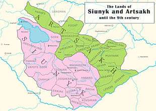
Historically, Syunik was one of the 15 provinces of the ancient Kingdom of Armenia. At various times, the region of present-day Syunik was also known by other names such as Syunia, Sisakan and Zangezur. However, the present-name of the province is derived from the ancient Armenian Siunia dynasty, who were the Naχarars (governors) of the historic province of Syunik since the 1st century.
Geography
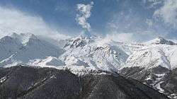
Syunik is located between the Nakhchivan Autonomous Republic of Azerbaijan from the west, and the de facto independent Nagorno-Karabakh Republic from the east. The Vayots Dzor Province of Armenia forms its northern borders, while Aras River at the south separates Syunik from Iran. Syunik covers an area of 4,506 km² (15% of total area of Armenia), making it the second-largest province in Armenia after Gegharkunik in terms of the total area.
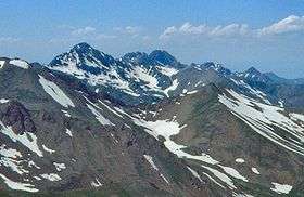
Historically, the current territory of the province occupies most of the historic Syunik province of Ancient Armenia.
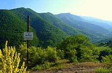
Syunik is a mountainous region, mainly covered with thick green forests. The Zangezur Mountains occupy most of the territories of Syunik. Mount Kaputjugh with a height of 3905 meters and Mount Gazanasar with a height of 3829 meters are the highest peaks of the province.
Many of the forests in Syunik are protected by the government, including the Arevik National Park, the Shikahogh State Reserve, the Boghakar Sanctuary, the Goris Sanctuary, the Plane Grove Sanctuary, the Sev Lake Sanctuary, and the Zangezur Sanctuary,
Major water basins include the rivers of Vorotan, Voghji, Sisian, Meghri and Vachagan.
Summer temperature can reach up to 40 °C, although the average temperature is around 22 °C, while in winter it may reach down to -12.5 °C. Its border with Nakhchivan to the west is defined by the Zangezur Mountains.

History
Ancient Kingdom of Armenia
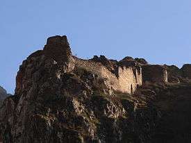
Inscriptions found in the region around Lake Sevan attributed to King Artaxias I confirm that the historic province of Syunik was part of the Artaxiad Kingdom of Armenia during the 2nd century BC.[3][4][5]
The first dynasty to rule Syunik was the Siunia dynasty, beginning in the 1st century. The first known Naχaarar ruler was Valinak Siak (c. 330) and his successor was his brother Andok or Andovk (Antiochus, c. 340). In 379 Babik (Bagben) the son of Andok, was re-established as a Naxarar by the Mamikonian family. Babik had a sister called Pharantzem who had married the Arsacid Prince Gnel, nephew of the Armenian King Arsaces II (Arshak II) and later married Arsaces II as her second husband. Babik’s rule lasted for less than ten years and by about 386 or 387, Dara was deposed by the Sassanid Empire.
Valinak (c. 400–409) was followed by Vasak (409–452). Vasak had two sons: Babik (Bagben), Bakur and a daughter who married Vasak’s successor, Varazvahan (452–472). Varazvahan’s son Gelehon ruled from 470–477, who died in 483. Babik (Bagben) the brother of Varazvahan became the new Naxarar in 477. Hadz the brother of Gelehon died on September 25 482. The Syunik Province was later governed by Vahan (c. 570), Philip (Philipo, c. 580), Stephen (Stephanos, c. 590–597), Sahak (Isaac, c. 597) and Grigor (Gregory, until 640).
Medieval Syunik

A dynasty was formed, governed by a branch of the Bagratuni, with minor vassal princes from one or more previous dynasties. Vasak III (c. 800) suffered an assault from the emir of Manazkert, Sevada. He established a garrison in Chalat, in the district of Dzoluk. He then called for help from the Persian revolutionary chief Babak Khorramdin, who married a daughter of the king.
After the death of Vasak III in 821, Babak inherited the country that revolted against him. Babak suppressed the revolt but was harassed by both Muslims and Armenians. Finally, he abdicated and the children of Vasak, Philip and Sahak, regained power. Philip controlled over eastern Syunik, including the cantons of the Vayots Dzor and Baghk. Sahak governed the western canton of Syunik, known as Gegharkunik.
In 826, Sahak allied with his ancient enemy – Sevada, the Qaisite emir of Manazkert – against the governor of Caliph, but he was defeated and died in Kavakert. His son Grigor-Sufan succeeded him as prince of Western Syunik. In the Eastern region, Philipo died on August 10, 848. He was succeeded by three children (Babgen, Vasak-Ichkhanik and Achot) that ruled jointly. Babgen fought with Grigor-Sufan and killed him (sometime in 849–851) but Babgen died shortly after (851) and Vasak-Ichkhanik (Vasak IV) followed him. Vasak-Ichkhanik had peaceful relations with Vasak-Gabor, who had ascended to the throne of Western Syunik, replacing his father Grigor-Sufan. Nerseh Pilippean, brother of Babgen, directed (822–23) [6] an expedition to Aghuania defeating and killing the prince Varaz-Terdat II[6] (of the Persian dynasty Mihrakane of Aghuania) in Morgog. A general sent by the Caliph, Bugha al-Kabir, destroyed Armenia and Aghuania in these years, and sent a detachment to Eastern Syunik where was governing Vasak IV with his brother Achot. The people of Syunik were sheltered in the fortress of Balq, but Vasak fled to Kotaiq, and was pursued to the region of Gardman on the eastern border of Lake Sevan. Gardman's prince (ichkhan) Ketridj or Ketritchn betrayed him and delivered him to Bogha (859). Achot was also seized (859). But Bogha invaded Gardman and imprisoned Kertridj. He then went to Outi where he captured the prince of Sevordiq, Stephannos Kun.
The Caliphate tried to control all these regions, and for this reason Bogha decided to repopulate the city of Chamkor in the Kura River with Muslims. Chamkor, being near Barda and Ganja, was intended to act as a regional monitoring post. By order of the new Caliph in 862, the imprisoned princes were to be released and allowed to return to their former domains on the condition of becoming Muslim. (However, they all abandoned Islam after their return.)
The prince of Western Syunik, Vasak-Gabor, was married to a daughter of the Bagratid prince Ashot the Great named Miriam, and received the title of Ichkhan from the Syunik people – delivered to him by Ashot in name of the Caliph. His successor was his son, Grigor-Sufan II (887–909). The prince of Eastern Syunik, Vasak IV, died around 887, and was followed by his brother Achot who died c. 906.
The son of Vasak IV, Sembat, that received the fiefdom from Vayots Dzor. Chahaponk (Jahuk) governed from 887 until sometime after 920. He revolted in 903 against the Bagratid Sembat I, refusing to pay him taxes. Because of this, he was assaulted by the prince of Vaspurakan, Sargis-Ashot. Sembat submitted, was forgiven and married to the sister of the prince of Vaspurakan, receiving the city and district of Nakhchivan, which in 902 was upset with the Kaysites or Qaisids.
A few years later, the prince allied with the emir of Sadjid, Yusuf, against Eastern Syunik, which they invaded together. Sembat was sheltered in the fortress of Erendchak (today Alindja, northeast of Nakhchivan) and Yusuf remained owner of Eastern Syunik. Sembat requested refuge from his brother-in-law Khatchik-Gagik, which was granted. In the same year (909), the prince of Western Syunik, Grigor Sufan II, submitted to the emir Yusuf in Dwin. Only Byzantine movements and the withdrawal of the Sadjids permitted him to recover the throne some time later. Sembat, with his three brothers Sahak, Babgen, and Vasak, governed again. Also in Western Syunik, Sahak, Ashot and Vasak, brothers of Grigor-Sufan II, were governing the country. After them the dynasty of Western Syunik became extinct and the territory was subsumed by the Muslims.
The eastern part remained divided: Sembat, which had the main title, governed the western part of the Eastern Syunik with the Vayots Dzor, bordered by Vaspurakan. Sahak governed the eastern part until the river Hakar. Babgen governed the district of the Balq, and Vasak (who died in 922) an indeterminate territory. Nasr, the emir of Azerbaijan, captured territory through perfidy against Babgen and Sahak in Dwin. After the invasion, Sembat unseated Nasr and obtained the freedom of his brothers. Sembat was followed by his son Vasak, and Sahak in turn by his son Sembat. Vasak received the royal title from the Muslims at the end of his reign, which lasted until 963.
Kingdom of Syunik
The throne was inherited by his nephew Sembat (963–998) who was recognized as king by the emirs of Tauris and of Arran. He was married to the princess of Aghuania, Chahandoukht. At his death, he was followed by Vasak (c. 998–1019). Vasak was succeeded by two nephews (the children of his sister and a Prince Achot) called Sembat and Grigor (1019–1084). During his periods Syunik was vassal of Great Seljuk Empire. Grigor was married with the princess Chahandoukht, daughter of Sevada of Aghuania. The only successor to the two princes, was a daughter of Grigor's called Chahandoukht. Rule passed to the prince of Aghuania, Seneqerim Ioan who governed both territories from 1084 until his death in 1105. Seneqerim Ioan was followed by his son Grigor of Syunik and Aghuania, who governed until 1166, when the country was conquered by the Seljuq Turks. It was ruled by Seljuks of Hamadan, Atabegs of Azerbaijan, Kingdom of Georgia, Khwarezmshahs, Ilkhanate, Chupanids, Jalayirids, Karakoyunlu Turcomans, Timurid Empire and Akkoyunlu Turcomans successively before Safavid rule. It was also ruled by Ottomans between 1578–1606 and again between 1722–1736.
Later, the Orbelian Dynasty, one of whose members wrote an important history of the country, governed Syunik in times of Timur (Tamerlan) as vassals. Between the middle of the 17th century and early in the 19th century, the region was part of the Karabakh khanate of the Safavid Empire. It was during this period in the region's history that David Bek headed an armed struggled against the Safavids and the Ottoman Empire.
Imperial Russian rule
Following the Russo-Persian War of 1826–1828, Syunik passed into Imperial Russian possession by the Treaty of Turkmenchay in 1813 together with the rest of the Karabakh khanate. The khanate was abolished by the Russian government in 1822. The region was divided into the Erivan Governorate and the Shemakha Governorate (Shemakha Governorate was renamed Baku Governorate in 1859). When the Elisabethpol Governorate was established in 1868, the region became the Zangezursky Uyezd, with its seat of administration in Geryusy.[7]
According to the official census of the Russian Empire in 1897, the total population of Zangezursky Uyezd was 137,971, with 51.6% of them were Caucasian Tatars and 46,1% were Armenians.[8]
The beginning of 20th century saw an outbreak in ethnic tensions between the Armenian and Tatar populations in the Caucasus, culminating in the Armenian-Tatar massacres. Clashes occurred in Nakhichevan and Sharur-Daralgez uyezdy of the Erevan gubernia and in Zangezur, Shusha and Javanshir uezdy of Elizavetpol gubernia in 1905. According to Armenian sources 128 Armenian and 158 Azerbaijanian villages were "pillaged or destroyed"[8] while the overall estimates of lives lost vary widely, ranging from 3,000 to 10,000, with Muslims suffering higher losses.[9] During these events, the Armenians of Syunik were massacred "without distinction of sex or age" by Azeri forces.[10]
Tensions were accelerated with the collapse of the Russian Empire. The region fell under the authority of the Special Transcaucasian Committee of the Russian Provisional Government and subsequently the short-lived Transcaucasian Democratic Federative Republic. When the TDFR was dissolved in May 1918, Zangezur, Nakhchivan, and Nagorno-Karabakh became heavily contested between the newly formed and short-lived states of the First Republic of Armenia and the Azerbaijan Democratic Republic. At the time, Syunik had an Armenian majority of 350,000 and a Muslim population of 180,000.[11] According to Thomas de Waal, the dispute over Syunik resulted in the displacement of region's Caucasian Tatar minority through direct military action by Armenian guerrilla commanders Andranik,[12] Rouben Ter Minassian[13] and later Garegin Nzhdeh.[14]
First Republic of Armenia

Between 1918 and 1920 Syunik was included in the short-lived Republic of Armenia. After the Sovietization of Armenia, Syunik became the main centre of the resistance against the Bolsheviks, thus becoming part of the unrecognized Republic of Mountainous Armenia under the leadership of Garegin Nzhdeh. The town of Goris was the de facto capital of the short-lived unrecognized state. However, after falling to the Bolsheviks in July 1921, Syunik was included within the Armenian SSR.
Soviet Syunik
Armenian forces eventually secured the region but their efforts were in vain when the Bolsheviks, successful in the Russian Civil War, pushed deep into the Caucasus. Syunik was one of the last major holdouts of the independent Armenian state whose leaders were eventually expelled by incoming Soviet authorities to Iran. During Sovietization, Syunik became part of Soviet Armenia, while the two other disputed territories, Nakhchivan and Nagorno-Karabakh became part of Soviet Azerbaijan. It then became part of Armenia under the Transcaucasian SFSR and part of the Armenian SSR in 1936. Under Soviet rule, Syunik suffered a devastating earthquake in April 1931, leaving 80% of its villages destroyed.[15] A subsequent earthquake hit the region in May during the same year, destroying 27 of 38 villages in the Sisian district.[16]
As an administrative unit, modern-day Syunik was divided into the raions of Meghri, Kapan, Goris and Sisian.
Despite the region's troubled early years in the Soviet Union, it gradually began to recover with much of the area's infrastructure rebuilt and improved. During the Soviet era, Syunik was noted as a source of metal and ore production.[17] However, the region was shaken by the renewal of the conflict over Nagorno-Karabakh with neighboring Azerbaijan. In 1987–1989, the remaining Azeri inhabitants fled the region as a result of interethnic violence.[18][19] This exodus of Azeri population made Syunik and Armenia in general more homogeneous.
Independence of Armenia
Since the collapse of the Soviet Union in 1991, Syunik has been a constituent part of the Republic of Armenia. After the independence of Armenia, the 4 raions of the Soviet Syunik were merged during the 1995 administrative reform, to form the Syunik Province with the town of Kapan as the provincial capital.
Being the republic's southernmost province, it has gained a strategic and economic importance for Armenia. The border with Iran enhanced the export of vital energy resources from Armenia to Iran and other regions. Recently, a new 140-kilometer-long Armenia-Iran pipeline has been opened, projected to supply Armenia with up to 1.1 billion m³ of gas per year until 2019, when the target of the supply is expected to rise to 2.3 billion m³ annually."[20] The new pipeline has attracted Armenia's northern neighbor Georgia, seeking to lessen its dependence on energy from Russia.
In 2000, an old cemetery was found between the villages of Kornidzor and Khndzoresk near Goris. It was built by Armenian architects during the Kara Koyunlu rule.[21]
Demographics
Population
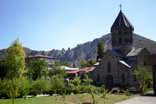
According to the 2011 official census, Syunik has a population of 141,771 (69,836 men and 71,935 women), forming around 4.7% of the entire population of Armenia. The urban population is 95,170 (67.13%) and the rural is 46,601 (32.87%). The province has 7 urban and 102 rural communities. The largest urban community is the provincial center of Kapan, with a population of 43,190. The other urban centres are Goris, Sisian, Kajaran, Meghri, Agarak and Dastakert.
With a population of 2,661, the village of Shinuhayr is the largest rural municipality of Syunik.
Ethnic groups and religion
Syunik is almost entirely populated by ethnic Armenians who belong to the Armenian Apostolic Church. The regulating body of the church is the Diocese of Syunik, headed by Rev. Fr. Zaven Yazichyan. The Saint Gregory Cathedral of Goris is the seat of the diocese.
Culture
Fortresses and archaeological sites
- Zorats Karer prehistoric archaeological site, is believed by many scientists including Paris Herouni and Onik Khnkikyan to be a prehistoric astronomical observatory,[22]
- Baghaberd fortress of the 4th century,
- Vorotnaberd fortress of the 5th century,
- Meghri Fortress of the 11th century,
- Halidzor Fortress of the 17th century,
- the artificial caves of Khndzoresk.
Churches and monasteries
- Surp Hovhannes Monastery of 691 of Sisian,
- Tatev monastery of the 9th century,
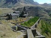
- Vorotnavank monastic complex of the 10th century,
- Vahanavank monastic complex of the 10th century,
- Bgheno-Noravank monastery of the 11th century,
- Tatevi Anapat monastic complex of the 17th century.
Economy
Agriculture
Around 74% (3,336 km²) of the total area of the province are arable lands, out of which 13.2% (440 km²) are ploughed.[23]
The rural population is mainly involved in agriculture and cattle-breeding. The province has a contribution of 6.5% of the annual total annual agricultural product of Armenia. The main crops are grains, dry grains, potato and vegetables.[24]
The village of Angeghakot has fish farming ponds, while the village of Achanan is home to a poultry farm.
Industry
Syunik as among the main contributing provinces in the industrial sector of Armenia. It has a share of 17% of the annual total industrial product of Armenia. The economy is of the province is mainly based on the industrial sector, including mining, building materials production and food-processing. The prospect of a uranium mine being exploited by the Russian State Nuclear Energy Corporation (Rosatom) in the village of Lernadzor.[25]
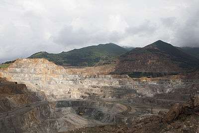
- The province is home to many of Armenia's largest mining operations including the Kapan mine and Kajaran Mine operated by the Zangezur Copper and Molybdenum Combine since 1951, based in Kajaran.[25] The town of Kajaran is also home to the "Danesia" company for roofing sheets founded in 2000.
- Kapan is home to a number of industrial firms operating in the industrial district of the town. The largest firms are the "Kapan CH.SH.SH." for building materials founded in 1947, the Kapan machine tools plant founded in 1972, the "Sonatex" knitting factory founded in 1985, and the "Marila LLC" for meat and dairy products founded in 2010.
- Goris is home to the Vorotan Hydropower Plant opened in 1989 and considered one of the main providers of electrical power in Armenia. Other large industrial firms in Goris include the "Vosmar" company for asphalt concrete and crushed stone founded in 2002, the "Goris Gamma" for electronic devices founded in 2003, and the "Goris Group" for bottled spring water founded in 2005.
- Sisian is home to the "Sis-Alp" dairy factory founded in 2007, the "Bazalt-M" building materials production plant founded in 2009, and the Sisian ceramics plant operating since 2014.
- The Meghri Cannery founded in 1930, and the Meghri Road-building enterprise for asphalt and concrete production founded in 1997, are also among the major industrial firms of the province. The town is also home to the Meghri Wine Factory.
- The Agarak Copper-Molybdenum mine complex produces copper and molybdenum concentrate through bulk-selective flotation recovery of molybdenum and copper minerals. It was fully acquired by "GeoProMining" company in 2007.
- The village of Shamb is home to the "Tatni Mineral Water Factory" founded in 2010.
Tourism
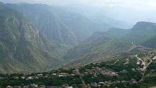
Tourism is among the developing sectors in the economy of Syunik. The towns of Goris and Kapan have a large number of different levels of hotels and inns.
The cultural heritage, as well as the natural beauty of the region attract many local and foreign tourists especially in the summer period. The Wings of Tatev (Armenian: Տաթևի թևեր Tatevi tever) cableway, operating since 16 October 2010 between Halidzor and the Tatev monastery, is the longest reversible aerial tramway built in only one section, and holds the record for Longest non-stop double track cable car. 5.7 km (3.5 mi)[26]
Many forests and woodlands of Syunik are among the protected areas of Armenia such as the Arevik National Park and Shikahogh State Reserve. The province has also the wildlife sanctuaries of Boghakar, Goris, Sev Lake, Zangezur and the Plane Grove of Shikahogh river.
Other touristic destinations of Syunik include the Mount Khustup and the Shaki Waterfall.
Education
Syunik is home to the Goris State University operating since 1967 in the town of Goris.
Branches of the Yerevan State University, National Polytechnic University of Armenia and Yerevan State Institute of Theatre and Cinematography are also operating in the province.
As of the 2015-16 educational year, Syunik has 119 schools.[27]
Sport
Football is the most populous sport in the province. FC Gandzasar Kapan represents Syunik at the Armenian Premier League. Gandzasar Stadium in Kapan is the largest sports venue of Syunik. Minor stadiums are also opened in Meghri, Goris and Sisian.
In 2013, FC Gandzasar Kapan opened its up-to-date training centre to become the only football training academy in southern Armenia. The centre has many regular-sized football pitches including one with artificial turf.
FC Zangezour of Goris were the other football team in the province. However, they were forced to dissolve in 1997 due to financial difficulties.
Other stadiums in the province include the Meghri City, Goris City, and Sisian City stadiums.
Communities
The province of Syunik consists of the following 102 communities (hamaynkner), of which 7 are considered urban and 95 are considered rural.[28]
Towns or urban communities
| Image | City (town) | Province | Founded | Land area (km2) | Population (2011 census) |
Population (2016 estimate) |
|---|---|---|---|---|---|---|
 | Agarak | Syunik | 1949 | 2.5 | 4,429 | 4,300 |
 | Dastakert | Syunik | 12th century (first mentioned) | 0.5 | 323 | 300 |
| Goris | Syunik | 1870 | 8 | 20,591 | 20,300 | |
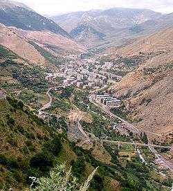 | Kajaran | Syunik | 1958 | 2.8 | 7,163 | 7,100 |
 | Kapan | Syunik | 10th century | 36 | 43,190 | 42,600 |
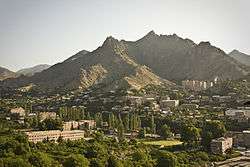 | Meghri | Syunik | 17th century | 3 | 4,580 | 4500 |
 | Sisian | Syunik | 8th century BC (first mentioned) | 9 | 14,894 | 14,900 |
Villages or urban communities
Non-communitiy villages
|
|
Former villages
- Aghbulagh, belongs to the Shurnukh community.
- Dzorak, belongs to the Shurnukh community.
- Geghavank, belongs to the Geghi community.
- Kard, belongs to the Geghi community.
- Karut, belongs to the Geghi community.
- Kitsk, belongs to the Geghi community.
- Nerkin Giratagh, belongs to the Lernadzor community.
- Vanand, belongs to the Shurnukh community.
- Verin Giratagh, belongs to the Lernadzor community.
- Verin Geghavank, belongs to the Geghi community.
- Vocheti, belongs to the Nor Astghaberd community.
Notable people
- Aram Manukian, statesman, founder of the First Republic of Armenia
- Aksel Bakunts, novelist
- Sero Khanzadyan, novelist
- Oksen Mirzoyan, weightlifter, Olympic and World champion
Gallery
 The "stone-pyramids" of Goris
- Zangezur Sanctuary

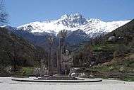 Monument to Garegin Nzhdeh and mount Khustup near Kapan
.jpg)
See also
References
- Report of the results of the 2001 Armenian Census, National Statistical Service of the Republic of Armenia
- ↑ Syunik population, 2011 census
- ↑ Report of the results of the 2001 Armenian Census, National Statistical Service of the Republic of Armenia
- ↑ Borisov ""nscriptions of Artaxia (Artashes), King of Armenia, 1946, No 2"
- ↑ Historical-Philological Magazine, 1965, No 4
- ↑ A.G. Perikhanyan, "Aramian Inscription from Zangezur"
- 1 2 Encyclopedia Iranica. C. E. Bosworth. Arran
- ↑ 1906 Brockhaus and Efron Encyclopedic Dictionary, "Зангезурский уезд" article.
- 1 2 Audrey L. Altstadt. The Azerbaijani Turks: power and identity under Russian rule. Hoover Press, 1992. ISBN 0-8179-9182-4, ISBN 978-0-8179-9182-1
- ↑ Tadeusz Swietochowski. Russia and Azerbaijan: A Borderland in Transition. Columbia University Press, 1995. ISBN 0-231-07068-3, ISBN 978-0-231-07068-3
- ↑ "Dispatch from St. Petersberg, Wednesday, Sept. 13". The New York Times. 1905-09-13. p. 4.
- ↑ "Georgians Hold Up Tartar's Advance". The New York Times. 1920-05-15. p. 14.
- ↑ Thomas de Waal. Black Garden: Armenia And Azerbaijan Through Peace and War. New York: New York University Press, pp. 129. ISBN 0-8147-1945-7
- ↑ The Great Game of Genocide: Imperialism, Nationalism, and the Destruction by Donald Bloxham. Oxford University Press: 2005, pp.103–105
- ↑ "Garegin Nzhdeh and the KGB: Report of Interrogation of Ohannes Hakopovich Devedjian" (in Russian). August 28, 1947. Archived from the original on October 30, 2007. Retrieved August 9, 2012.
- ↑ "392 Dead in Quake on Soviet Frontier". The New York Times. 1931-04-30. p. 10.
- ↑ "Armenian Quake a Major Disaster". The New York Times. 1931-05-06. p. 9.
- ↑ "Soviet is Raising Output of Key Ore". The New York Times. 1963-05-23. p. 68.
- ↑ Situation of refugees and displaced persons in Armenia, Azerbaijan and Georgia
- ↑ Thomas de Waal. Black Garden: Armenia and Azerbaijan through Peace and War: Armenia and Azerbaijan through Peace and War. NYU Press; 2004.
- ↑ "Georgia Shows Interest In Iran-Armenia Pipeline". EurasiaNet. 2007-04-12. Retrieved 2007-06-21.
- ↑ "The Historical Heritage Of Gara Goyunly Dynasty In Armenia". ASIMED. 2008-06-01. Retrieved 2008-08-04.
- ↑ Paris Herouni, Armenians and Old Armenia, Yerevan, 2004.
- ↑ Armstat: Syunik Province
- ↑
- 1 2 The Specter of Uranium Once Again Hangs Over Syunik, Hetq Online, November 10, 2008.
- ↑ "Longest non-stop double track cable car". Guinness World Records. Retrieved 23 August 2011.
- ↑ Syunik Province schools
- ↑ Community mergers in Armenia
External links
| Wikimedia Commons has media related to Syunik Province. |
- Syunik portal
- Syunik Tourist Guide
- Syunik at the site of Ministry of Urban Development
- Syunik at Armeniainfo
