Sumter County, South Carolina
| Sumter County, South Carolina | |
|---|---|
|
Sumter County Courthouse, Sumter | |
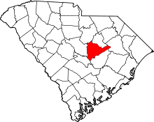
 Location in the U.S. state of South Carolina | |
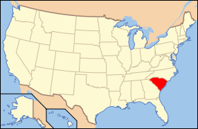
 South Carolina's location in the U.S. | |
| Founded | 1800 |
| Named for | Thomas Sumter |
| Seat | Sumter |
| Largest city | Sumter |
| Area | |
| • Total | 682 sq mi (1,766 km2) |
| • Land | 665 sq mi (1,722 km2) |
| • Water | 17 sq mi (44 km2), 2.5% |
| Population (est.) | |
| • (2015) | 107,480 |
| • Density | 162/sq mi (63/km²) |
| Congressional districts | 5th, 6th |
| Time zone | Eastern: UTC-5/-4 |
| Website |
www |
Sumter County is a county located in the U.S. state of South Carolina. As of the 2010 census, the population was 107,456; in a 2013 census estimate, the population was at 108,123.[1] Its county seat is Sumter.[2] The county was created in 1800.[3]
Sumter County comprises the Sumter, South Carolina Metropolitan Statistical Area.
It is the home of Shaw AFB, headquarters to the 9th Air Force, AFCENT, United States Army Central, with a number of other tenant units. It is one of largest bases in the USAF's Air Combat Command.
Geography
According to the U.S. Census Bureau, the county has a total area of 682 square miles (1,770 km2), of which 665 square miles (1,720 km2) is land and 17 square miles (44 km2) (2.5%) is water.[4] It is drained by the Black River and its tributaries.[5] Its western border is formed by the Wateree River.
Adjacent counties
- Lee County - north
- Florence County - northeast
- Clarendon County - south
- Calhoun County - southwest
- Richland County - west
- Kershaw County - northwest
Demographics
| Historical population | |||
|---|---|---|---|
| Census | Pop. | %± | |
| 1800 | 3,571 | — | |
| 1810 | 19,054 | 433.6% | |
| 1820 | 25,269 | 32.6% | |
| 1830 | 28,277 | 11.9% | |
| 1840 | 27,892 | −1.4% | |
| 1850 | 33,220 | 19.1% | |
| 1860 | 23,859 | −28.2% | |
| 1870 | 25,268 | 5.9% | |
| 1880 | 37,037 | 46.6% | |
| 1890 | 43,605 | 17.7% | |
| 1900 | 51,237 | 17.5% | |
| 1910 | 38,472 | −24.9% | |
| 1920 | 43,040 | 11.9% | |
| 1930 | 45,902 | 6.6% | |
| 1940 | 52,463 | 14.3% | |
| 1950 | 57,634 | 9.9% | |
| 1960 | 74,941 | 30.0% | |
| 1970 | 79,425 | 6.0% | |
| 1980 | 88,243 | 11.1% | |
| 1990 | 102,637 | 16.3% | |
| 2000 | 104,646 | 2.0% | |
| 2010 | 107,456 | 2.7% | |
| Est. 2015 | 107,480 | [6] | 0.0% |
| U.S. Decennial Census[7] 1790-1960[8] 1900-1990[9] 1990-2000[10] 2010-2013[1] | |||
As of the 2010 United States Census, there were 107,456 people, 40,398 households, and 28,311 families residing in the county.[11] The population density was 161.6 inhabitants per square mile (62.4/km2). There were 46,011 housing units at an average density of 69.2 per square mile (26.7/km2).[12] The racial makeup of the county was 48.2% white, 46.9% black or African American, 1.1% Asian, 0.4% American Indian, 0.1% Pacific islander, 1.4% from other races, and 1.9% from two or more races. Those of Hispanic or Latino origin made up 3.3% of the population.[11] In terms of ancestry, 7.2% were Subsaharan African, 6.9% were American, 6.1% were English, 5.9% were German, and 5.7% were Irish.[13]
Of the 40,398 households, 36.5% had children under the age of 18 living with them, 44.6% were married couples living together, 20.2% had a female householder with no husband present, 29.9% were non-families, and 25.8% of all households were made up of individuals. The average household size was 2.59 and the average family size was 3.11. The median age was 35.4 years.[11]
The median income for a household in the county was $39,137 and the median income for a family was $45,460. Males had a median income of $36,101 versus $28,421 for females. The per capita income for the county was $18,944. About 15.5% of families and 19.4% of the population were below the poverty line, including 29.1% of those under age 18 and 14.7% of those age 65 or over.[14]
Communities
Cities
- Sumter (county seat)
Towns
Census-designated places
Unincorporated communities
Notable residents
- Ray Allen, professional NBA basketball player is from Dalzell.
- Bill Pinkney of The Drifters was born in Dalzell.
- Sloman Moody, born in Horatio.
See also
- Lake Marion
- University of South Carolina Sumter
- National Register of Historic Places listings in Sumter County, South Carolina
References
- 1 2 "State & County QuickFacts". United States Census Bureau. Retrieved 14 Apr 2014.
- ↑ "Find a County". National Association of Counties. Retrieved 2011-06-07.
- ↑ "South Carolina: Individual County Chronologies". South Carolina Atlas of Historical County Boundaries. The Newberry Library. 2009. Retrieved March 21, 2015.
- ↑ "2010 Census Gazetteer Files". United States Census Bureau. August 22, 2012. Retrieved March 19, 2015.
- ↑
 Ripley, George; Dana, Charles A., eds. (1879). "Sumter, the name of four counties in the United States. I. An E. county of South Carolina". The American Cyclopædia.
- ↑ "County Totals Dataset: Population, Population Change and Estimated Components of Population Change: April 1, 2010 to July 1, 2015". Retrieved July 2, 2016.
- ↑ "U.S. Decennial Census". United States Census Bureau. Retrieved March 19, 2015.
- ↑ "Historical Census Browser". University of Virginia Library. Retrieved March 19, 2015.
- ↑ Forstall, Richard L., ed. (March 27, 1995). "Population of Counties by Decennial Census: 1900 to 1990". United States Census Bureau. Retrieved March 19, 2015.
- ↑ "Census 2000 PHC-T-4. Ranking Tables for Counties: 1990 and 2000" (PDF). United States Census Bureau. April 2, 2001. Retrieved March 19, 2015.
- 1 2 3 "DP-1 Profile of General Population and Housing Characteristics: 2010 Demographic Profile Data". United States Census Bureau. Retrieved 2016-03-11.
- ↑ "Population, Housing Units, Area, and Density: 2010 - County". United States Census Bureau. Retrieved 2016-03-11.
- ↑ "DP02 SELECTED SOCIAL CHARACTERISTICS IN THE UNITED STATES – 2006-2010 American Community Survey 5-Year Estimates". United States Census Bureau. Retrieved 2016-03-11.
- ↑ "DP03 SELECTED ECONOMIC CHARACTERISTICS – 2006-2010 American Community Survey 5-Year Estimates". United States Census Bureau. Retrieved 2016-03-11.
External links
- Sumter County official website
- Central Carolina Technical College
- Sumter County SC Community
- Sumter Economic Development
 |
Kershaw County | Lee County | Florence County |  |
| Richland County | |
|||
| ||||
| | ||||
| Calhoun County | Clarendon County |
Coordinates: 33°55′N 80°23′W / 33.92°N 80.38°W