St. Cloud Regional Airport
| St. Cloud Regional Airport | |||||||||||||||
|---|---|---|---|---|---|---|---|---|---|---|---|---|---|---|---|
 | |||||||||||||||
| IATA: STC – ICAO: KSTC – FAA LID: STC | |||||||||||||||
| Summary | |||||||||||||||
| Airport type | Public | ||||||||||||||
| Owner | City of St. Cloud | ||||||||||||||
| Serves | St. Cloud, Minnesota | ||||||||||||||
| Elevation AMSL | 1,031 ft / 314 m | ||||||||||||||
| Coordinates | 45°32′48″N 094°03′36″W / 45.54667°N 94.06000°WCoordinates: 45°32′48″N 094°03′36″W / 45.54667°N 94.06000°W | ||||||||||||||
| Website | www.StCloudAirport.com | ||||||||||||||
| Map | |||||||||||||||
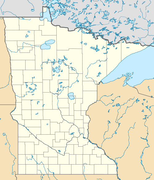
 STC  STC Location of airport in Minnesota/United States | |||||||||||||||
| Runways | |||||||||||||||
| |||||||||||||||
| Statistics (Year end 9/30/2015) | |||||||||||||||
| |||||||||||||||
St. Cloud Regional Airport (IATA: STC, ICAO: KSTC, FAA LID: STC) is a city owned, public use airport in Sherburne County, Minnesota, United States.[1] It is located four nautical miles (5 mi, 7 km) east of the central business district of the city of St. Cloud, which owns and operates the airport.[1] The airport serves private, commercial, corporate, cargo and military operations. Mostly used for general aviation, it is also served by one commercial airline.
This airport is included in the National Plan of Integrated Airport Systems for 2011–2015, which categorized it as a primary commercial service airport.[2] As per Federal Aviation Administration records, the airport had 20,161 passenger boardings (enplanements) in calendar year 2008,[3] 14,294 enplanements in 2009, and 1,198 in 2010.[4] Mesaba Airlines, operating flights for Delta Connection, ended service to Minneapolis/St. Paul on December 31, 2009. Allegiant Air began service to Phoenix on December 15, 2012.
Facilities and aircraft
St. Cloud Regional Airport covers an area of 1,414 acres (572 ha) at an elevation of 1,031 feet (314 m) above mean sea level. It has two runways: 13/31 is 7,000 by 150 feet (2,134 x 46 m) with a concrete surface and 5/23 is 3,000 by 75 feet (914 x 23 m) with an asphalt surface.[1]
For the 12-month period ending November 30, 2011, the airport had 34,510 aircraft operations, an average of 94 per day: 92.6% general aviation, 6.5% military, 0.9% air taxi, and <1% scheduled commercial. At that time there were 76 aircraft based at this airport: 73.7% single-engine, 15.8% military, 6.6% jet, 2.6% multi-engine, and 1.3% helicopter.[1]
Airlines and destinations
| Airlines | Destinations |
|---|---|
| Allegiant Air | Seasonal: Phoenix/Mesa |
| Sun Country Airlines | Charter: Laughlin/Bullhead City |
Statistics
| Rank | Airport | Passengers | Carriers |
|---|---|---|---|
| 1 | Phoenix/Mesa, AZ | 15,000 | Allegiant |
| 2 | Laughlin/Bullhead City, AZ | 1,000 | Sun Country |
References
- 1 2 3 4 5 FAA Airport Master Record for STC (Form 5010 PDF). Federal Aviation Administration. Effective November 15, 2012.
- ↑ "2011–2015 NPIAS Report, Appendix A" (PDF, 2.03 MB). National Plan of Integrated Airport Systems. Federal Aviation Administration. October 4, 2010. External link in
|work=(help) - ↑ "Enplanements for CY 2008" (PDF, 1.0 MB). CY 2008 Passenger Boarding and All-Cargo Data. Federal Aviation Administration. December 18, 2009. External link in
|work=(help) - ↑ "Enplanements for CY 2010" (PDF, 189 KB). CY 2010 Passenger Boarding and All-Cargo Data. Federal Aviation Administration. October 4, 2011. External link in
|work=(help) - ↑ Cloud, MN: St. Cloud Regional&carrier=FACTS "St Cloud Regional (STC) Summary Statistics" Check
|url=value (help).
External links
- St. Cloud Regional Airport, official site
- St. Cloud Regional Airport at Minnesota DOT Airport Directory
- Aerial image as of April 1991 from USGS The National Map
- FAA Airport Diagram (PDF), effective December 8, 2016
- FAA Terminal Procedures for STC, effective December 8, 2016
- Resources for this airport:
- FAA airport information for STC
- AirNav airport information for KSTC
- ASN accident history for STC
- FlightAware airport information and live flight tracker
- NOAA/NWS latest weather observations
- SkyVector aeronautical chart, Terminal Procedures