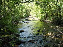
Watab River

The Watab River, also known as Watab Creek, is a 9.8-mile-long (15.8 km)[1] tributary of the Mississippi River in Stearns County in central Minnesota in the United States. It rises north of St. Joseph at the confluence of its North and South Forks, and flows northeast through Watab Lake, then east into the Mississippi River at Sartell.
The North Fork Watab River, 6.9 miles (11.1 km) long,[1] rises in Pflueger Lake, flows northeasterly to Stump Lake, then southeasterly near Collegeville, merging with the South Fork near St. Joseph.
The South Fork Watab River, 12.7 miles (20.4 km) long,[1] flows southeast from Big Watab Lake to Little Watab Lake, and through a pond before flowing northeast and into North Fork Watab River.
History
The word watab comes from the Anishinaabe/Ojibwe language wadab-ziibi ("river with spruce-roots") due to the exposed spruce roots once found along its banks, which comes from the Algonquian watap, the cordage used for sewing together the birch-bark panels on a canoe.[2]
In 1825[3] the Watab formed the first part of the border on the west side of the Mississippi between the Anishinaabe/Ojibwe to the north and the Dakota/Sioux to the south, and 20 years later the southern boundary for the Winnebago/Ho-Chunk Long Prairie Reservation of less than ten years' duration.
See also
References
- 1 2 3 U.S. Geological Survey. National Hydrography Dataset high-resolution flowline data. The National Map, accessed November 29, 2012
- ↑ Upham, Warren (1920). Minnesota Geographic Names: Their Origin and Historic Significance. Minnesota Historical Society. p. 51.
- ↑ "1825 Treaty with the Sioux and Chippewa, Sacs and Fox, Menominie, Ioway, Sioux, Winnebago, and a portion of the Ottawa, Chippewa, and Potawattomie, Tribes; at Prairie des Chiens". Oklahoma State University Library. Retrieved 2012-08-28.