Solec Kujawski
| Solec Kujawski | |||
|---|---|---|---|
 | |||
| |||
 Solec Kujawski | |||
| Coordinates: 53°5′N 18°14′E / 53.083°N 18.233°ECoordinates: 53°5′N 18°14′E / 53.083°N 18.233°E | |||
| Country |
| ||
| Voivodeship | Kuyavian-Pomeranian | ||
| County | Bydgoszcz | ||
| Gmina | Solec Kujawski | ||
| Area | |||
| • Total | 18.68 km2 (7.21 sq mi) | ||
| Population (2006) | |||
| • Total | 15,060 | ||
| • Density | 810/km2 (2,100/sq mi) | ||
| Postal code | 86-050 | ||
| Website | http://www.soleckujawski.pl | ||
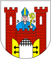
Solec Kujawski [ˈsɔlɛt͡s kuˈjafskʲi] (German: Schulitz) is a town with 15,505 inhabitants and an area of 176 km², situated 14 kilometres southeast of Bydgoszcz in Poland at 53°4′N 18°14′E / 53.067°N 18.233°E. Solec Kujawski belongs to the Kuyavian-Pomeranian Voivodeship. The town features Saint Stanislaus in its coat of arms.
Urban parts
- Makowiska
- Otorowo
- Przyłubie
- Solec Kujawski - City
- Wypaleniska
Massacre during Second World War
During the German Invasion of Poland in 1939, Wehrmacht soldiers and local German minority members murdered 44 people from the town on 14 September. Some of the victims were brutally beaten with rifles (up to the point that they broke apart).[1]
Points of interest
South of Solec Kujawski there is the longwave-transmitter Solec Kujawski.
References
- ↑ Szymon Datner "55 dni Wehrmachtu w Polsce" page 387-388
This article is issued from Wikipedia - version of the 12/27/2014. The text is available under the Creative Commons Attribution/Share Alike but additional terms may apply for the media files.

