Santa Isabel, La Pampa
| Santa Isabel | |
|---|---|
| Town | |
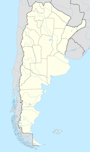
 Santa Isabel Location of Santa Isabel in Argentina | |
| Coordinates: 36°15′S 66°56′W / 36.250°S 66.933°WCoordinates: 36°15′S 66°56′W / 36.250°S 66.933°W | |
| Country |
|
| Province | La Pampa |
| Department | Chalileo |
| Population | |
| • Total | 2,493 |
| Time zone | ART (UTC-3) |
| CPA base | L6321 |
| Dialing code | +54 2338 |
Santa Isabel is a town in the province of La Pampa, Argentina. It had 2,493 inhabitants at the 2001 census [INDEC], and is the head town of the Chalileo Department. It lies on the west of the province, 240 km from the provincial capital Santa Rosa, by National Route 143, near the junction of the borders of the provinces of La Pampa, San Luis and Mendoza, in the area of the Atuel River marshlands.
Climate
| Climate data for Santa Isabel, La Pampa (1951–1960 and 1978–1985) | |||||||||||||
|---|---|---|---|---|---|---|---|---|---|---|---|---|---|
| Month | Jan | Feb | Mar | Apr | May | Jun | Jul | Aug | Sep | Oct | Nov | Dec | Year |
| Record high °C (°F) | 42.4 (108.3) |
40.3 (104.5) |
38.9 (102) |
33.0 (91.4) |
30.5 (86.9) |
26.8 (80.2) |
28.0 (82.4) |
30.1 (86.2) |
33.2 (91.8) |
39.4 (102.9) |
39.2 (102.6) |
42.3 (108.1) |
42.4 (108.3) |
| Average high °C (°F) | 32.8 (91) |
31.3 (88.3) |
29.0 (84.2) |
23.0 (73.4) |
19.8 (67.6) |
14.6 (58.3) |
15.6 (60.1) |
18.5 (65.3) |
21.8 (71.2) |
24.4 (75.9) |
29.0 (84.2) |
31.7 (89.1) |
24.3 (75.7) |
| Daily mean °C (°F) | 24.2 (75.6) |
22.8 (73) |
20.6 (69.1) |
15.0 (59) |
11.4 (52.5) |
7.0 (44.6) |
7.9 (46.2) |
9.2 (48.6) |
13.0 (55.4) |
15.9 (60.6) |
20.2 (68.4) |
23.2 (73.8) |
15.8 (60.4) |
| Average low °C (°F) | 14.8 (58.6) |
13.6 (56.5) |
11.8 (53.2) |
7.2 (45) |
3.4 (38.1) |
−0.2 (31.6) |
0.6 (33.1) |
1.0 (33.8) |
2.3 (36.1) |
7.1 (44.8) |
10.4 (50.7) |
13.4 (56.1) |
7.2 (45) |
| Record low °C (°F) | 3.4 (38.1) |
0.4 (32.7) |
0.6 (33.1) |
−4.6 (23.7) |
−8.6 (16.5) |
−11.4 (11.5) |
−14.4 (6.1) |
−11.3 (11.7) |
−10.1 (13.8) |
−4.1 (24.6) |
−1.1 (30) |
1.3 (34.3) |
−14.4 (6.1) |
| Average precipitation mm (inches) | 48 (1.89) |
48 (1.89) |
58 (2.28) |
35 (1.38) |
15 (0.59) |
14 (0.55) |
14 (0.55) |
11 (0.43) |
24 (0.94) |
43 (1.69) |
54 (2.13) |
52 (2.05) |
416 (16.38) |
| Average relative humidity (%) | 44 | 44 | 52 | 61 | 62 | 67 | 62 | 52 | 48 | 48 | 45 | 41 | 50 |
| Source: Secretaria de Mineria[1] | |||||||||||||
References
- ↑ "Provincia de La Pampa - Clima Y Meteorologia" (in Spanish). Secretaria de Mineria de la Nacion (Argentina). Archived from the original on July 7, 2015. Retrieved September 10, 2015.
- Municipal information: Municipal Affairs Federal Institute (IFAM), Municipal Affairs Secretariat, Ministry of Interior, Argentina. (Spanish)
This article is issued from Wikipedia - version of the 9/9/2016. The text is available under the Creative Commons Attribution/Share Alike but additional terms may apply for the media files.