Rockdale County, Georgia
| Rockdale County, Georgia | |
|---|---|
 Rockdale County Courthouse in Conyers | |
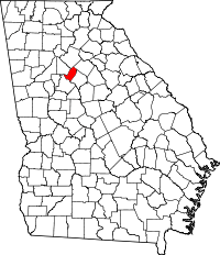
 Location in the U.S. state of Georgia | |
 Georgia's location in the U.S. | |
| Founded | October 18, 1870 |
| Seat | Conyers |
| Largest city | Conyers |
| Area | |
| • Total | 132 sq mi (342 km2) |
| • Land | 130 sq mi (337 km2) |
| • Water | 2.3 sq mi (6 km2), 1.7% |
| Population | |
| • (2010) | 85,215 |
| • Density | 657/sq mi (254/km²) |
| Congressional district | 4th |
| Time zone | Eastern: UTC-5/-4 |
| Website |
www |
Rockdale County is a county located in the U.S. state of Georgia. As of the 2010 census, the population was 85,215.[1] The county seat is Conyers.[2]
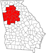
Rockdale County is included in the Atlanta-Sandy Springs-Roswell, GA Metropolitan Statistical Area.
History

Rockdale County was created on October 18, 1870[3][4] and received its name from Rockdale Baptist Church (est. 1846), which was named after the granite strata that rests under the county's red clay top soil. A bill introduced by John F. Hardin and John Harris carved Rockdale out of the northern portion of Newton County; parts of Rockdale County also came from neighboring Henry, Walton, Gwinnett, and DeKalb counties. Conyers, Rockdale's only incorporated town and urban center, became the county seat.
Prior to Rockdale becoming a county, the land had been inhabited by the Creek and Cherokee; the boundary between the two native nations, the Hightower Trail, ran directly through area. Burial remains have been discovered in the Honey Creek and Hi-Roc areas. Whites began migrating to the area in the early 19th century and initial white settlers suffered from Indian raids. Early white settlements developed along Big Haynes Creek in the northern part of the county, the Yellow River in the middle portion of the county, and Honey Creek in the south. Communities formed around grist mills and newly formed churches such as Haralson Mill, Costleys Mill, Dial Mill, Zacharys Mill, McElroys Mill, Union Grove Baptist Church, Ebenezer Methodist Church, Philadelphia Methodist Church, Salem Baptist Church, Smyrna Presbyterian Church, Pleasant Hill Baptist Church, Bethel Christian Church, Honey Creek Baptist Church. Other communities included Magnet and Zingara. These settlers were largely subsistence farmers.
During the American Civil War, General William Tecumseh Sherman marched the Union Army north of Conyers on his way to Covington from Lithonia. The usual seizure and destruction of property accompanied the army's march through the area. Many of the residents of Conyers, fearing Sherman would raze the city, fled to nearby Social Circle in Walton County, since Conyers was an important stop on the Georgia Railroad. Conyers remained unscathed by the war, and the city is a fine example of residential and commercial architecture from the 19th century. According to a historical marker on U.S. Highway 278 west of Conyers, Major General Joseph Wheeler of the Confederate States Army and part of his staff were captured by Union troops pursuing Jefferson Davis on May 9, 1865. Wheeler was later released in Athens only to be recaptured again. He was wounded three times, had his horse shot out from under him sixteen times.
During Reconstruction, Conyers and Rockdale County experienced tremendous growth. According to the local newspaper, The Weekly Farmer, the population of Conyers increased from 300 to 2,000. The number of stores, businesses, schools, and churches of the county rapidly multiplied as well. Parts of the county were infamous for moonshining and the county became dry in 1882, prohibiting the sale and manufacture of liquor except by a licensed pharmacist as prescribed by a physician. The economy of the county was still based primarily on agriculture into the early 20th century. The PBS documentary The Lost Children of Rockdale County is about a syphilis outbreak which occurred in the county during the 1990s.
Geography
According to the U.S. Census Bureau, the county has a total area of 132 square miles (340 km2), of which 130 square miles (340 km2) is land and 2.3 square miles (6.0 km2) (1.7%) is water.[5] It is the second-smallest county in Georgia by area.
The entirety of Rockdale County is located in the Upper Ocmulgee River sub-basin of the Altamaha River basin.[6]
Major highways
-
 Interstate 20
 -
 U.S. Route 278
 -
 State Route 12
 -
 State Route 20
 -
 State Route 138
 -
 State Route 162
 -
 State Route 212
 -
 State Route 402 (unsigned designation for I-20)
The county features an interchange of I-20 and SR 20. In order to ease potential motorist confusion, the concurrency of SR 20 & 138 is usually called just "138".
Adjacent counties
- Gwinnett County – north
- Walton County – northeast
- Newton County – east
- Henry County – southwest
- DeKalb County – west
Demographics
| Historical population | |||
|---|---|---|---|
| Census | Pop. | %± | |
| 1880 | 6,838 | — | |
| 1890 | 6,813 | −0.4% | |
| 1900 | 7,515 | 10.3% | |
| 1910 | 8,916 | 18.6% | |
| 1920 | 9,521 | 6.8% | |
| 1930 | 7,247 | −23.9% | |
| 1940 | 7,724 | 6.6% | |
| 1950 | 8,464 | 9.6% | |
| 1960 | 10,572 | 24.9% | |
| 1970 | 18,152 | 71.7% | |
| 1980 | 36,747 | 102.4% | |
| 1990 | 54,091 | 47.2% | |
| 2000 | 70,111 | 29.6% | |
| 2010 | 85,215 | 21.5% | |
| Est. 2015 | 88,856 | [7] | 4.3% |
| U.S. Decennial Census[8] 1790-1960[9] 1900-1990[10] 1990-2000[11] 2010-2013[1] | |||
According to the 2010 U.S Census, the racial makeup of the county was 40.9% White, 45.8% Black, 0.2% American Indian, 1.8% Asian, 0.1% Native Hawaiian or Pacific Islander, 0.3% Other race, and 1.6% from two or more races. 9.5% of the population was Hispanic or Latino.
There were 24,052 households out of which 39.10% had children under the age of 18 living with them, 61.60% were married couples living together, 12.40% had a female householder with no husband present, and 21.50% were non-families. 16.90% of all households were made up of individuals and 5.30% had someone living alone who was 65 years of age or older. The average household size was 2.87 and the average family size was 3.20.
In the county the population was spread out with 27.50% under the age of 18, 8.80% from 18 to 24, 30.50% from 25 to 44, 24.00% from 45 to 64, and 9.20% who were 65 years of age or older. The median age was 35 years. For every 100 females there were 98.80 males. For every 100 females age 18 and over, there were 96.40 males.
The median income for a household in the county was $53,599, and the median income for a family was $60,065. Males had a median income of $41,087 versus $29,189 for females. The per capita income for the county was $22,300. About 5.70% of families and 8.20% of the population were below the poverty line, including 10.00% of those under age 18 and 7.70% of those age 65 or over.
Education
Notable people
- Jill Arrington, ESPN college football reporter
- Billy Buckner, Current major league baseball player
- Cartel's Will Pugh, Joseph Pepper, Jeff Lett, Nic Hudson, & Kevin Sanders
- David Elder, Former Major League Baseball Player
- Dakota Fanning, actress
- Elle Fanning, actress
- Holly Hunter, actress
- John Mark Karr, JonBenét Ramsey's falsely claimed murderer
- Clint Mathis, World Cup soccer player
- Jack McBrayer, actor
- Kevin Ware, Current College Basketball player
Attractions
- Georgia International Horse Park
- Black Shoals Lake and Covered Bridge
- Old Towne Conyers Historic District
- Monastery of the Holy Spirit
- Salem Campground
- Smyrna Campground
- Milstead Historic Mill Village
- Panola Mountain State Park
- Rockdale Baptist Church
- Georgia Revolution FC
Communities
City
Unincorporated communities
- Ebenezer
- Honey Creek
- Lakeview Estates
- Magnet
- Milstead
- Oak Hill
- Pleasant Hill
- Princeton
- Salem
- Union Grove
- Zingara
See also
Sources
- Margaret G. Barksdale, E. L. Cowan, Francis A. King, eds. A History of Rockdale County (Conyers, Ga., 1978).
- The Heritage of Rockdale County, Georgia (Waynesville, N.C., 1998).
References
- 1 2 "State & County QuickFacts". United States Census Bureau. Retrieved June 25, 2014.
- ↑ "Find a County". National Association of Counties. Retrieved 2011-06-07.
- ↑ "History of Rockdale County". Rockdale County. Retrieved June 28, 2014.
- ↑ "Rockdale County". Georgia.gov. Retrieved June 28, 2014.
- ↑ "US Gazetteer files: 2010, 2000, and 1990". United States Census Bureau. 2011-02-12. Retrieved 2011-04-23.
- ↑ "Georgia Soil and Water Conservation Commission Interactive Mapping Experience". Georgia Soil and Water Conservation Commission. Retrieved 2015-11-18.
- ↑ "County Totals Dataset: Population, Population Change and Estimated Components of Population Change: April 1, 2010 to July 1, 2015". Retrieved July 2, 2016.
- ↑ "U.S. Decennial Census". United States Census Bureau. Retrieved June 25, 2014.
- ↑ "Historical Census Browser". University of Virginia Library. Retrieved June 25, 2014.
- ↑ "Population of Counties by Decennial Census: 1900 to 1990". United States Census Bureau. Retrieved June 25, 2014.
- ↑ "Census 2000 PHC-T-4. Ranking Tables for Counties: 1990 and 2000" (PDF). United States Census Bureau. Retrieved June 25, 2014.
External links
- Rockdale County Historic Maps
- Rockdale County Courthouse
- The Rockdale Citizen
- The Rockdale News
- Conyers-Rockdale Chamber of Commerce
- Conyers Convention and Visitor's Bureau
- The Lost Children of Rockdale County
 |
Gwinnett County |  | ||
| DeKalb County | |
Newton County and Walton County | ||
| ||||
| | ||||
| Henry County |
Template:Georgia
Coordinates: 33°39′N 84°02′W / 33.65°N 84.03°W
