Rancho Otay
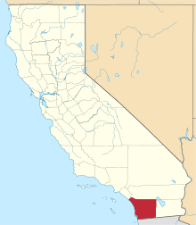
Rancho Otay was a 6,658-acre (26.94 km2) Mexican land grant in present-day San Diego County, California given in 1829 by Governor Pío Pico to Magdelena Estudillo.[1] The grant in the present-day Otay Mesa area, extended along the Otay River, just west of Lower Otay Reservoir.
History
The two square league grant was made to Magdalena Estudillo, whose brother, José Antonio Estudillo, was grantee of the adjoining one square league Rancho Janal. The two grants, both to members of the Estudillo family, are often considered as one rancho. The Estudillos were absentee ranchers, living in the pueblo of San Diego.[2]
With the cession of California to the United States following the Mexican-American War, the 1848 Treaty of Guadalupe Hidalgo provided that the land grants would be honored. As required by the Land Act of 1851, a claim for Rancho Otay was filed with the Public Land Commission in 1852,[3] and the grant was patented to Magdelena Estudillo in 1872.[4]
See also
- Ranchos of San Diego County, California
References
- ↑ Ogden Hoffman, 1862, Reports of Land Cases Determined in the United States District Court for the Northern District of California, Numa Hubert, San Francisco
- ↑ R.W. Brackett, 1939,A History of the Ranchos of San Diego County, California, Union Title Insurance and Trust Company.
- ↑ United States. District Court (California : Southern District) Land Case 66 SD
- ↑ Report of the Surveyor General 1844 - 1886
Coordinates: 32°36′36″N 116°58′12″W / 32.610°N 116.970°W
