Rakova Steza
| Rakova Steza | |
|---|---|
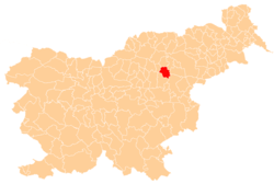
 Rakova Steza Location in Slovenia | |
| Coordinates: 46°19′31.38″N 15°18′18.26″E / 46.3253833°N 15.3050722°ECoordinates: 46°19′31.38″N 15°18′18.26″E / 46.3253833°N 15.3050722°E | |
| Country |
|
| Traditional region | Styria |
| Statistical region | Savinja |
| Municipality | Vojnik |
| Area | |
| • Total | 0.82 km2 (0.32 sq mi) |
| Elevation | 378.1 m (1,240.5 ft) |
| Population (2002) | |
| • Total | 39 |
| [1] | |
Rakova Steza (pronounced [ˈɾaːkɔʋa stəˈza] or [ˈɾaːkɔʋa ˈstəza]) is a small settlement east of Frankolovo in the Municipality of Vojnik in eastern Slovenia. The area is part of the traditional region of Styria and is now included with the rest of the municipality in the Savinja Statistical Region.[2]
References
External links
| Settlements | Administrative centre: Vojnik
|  |
|---|---|---|
| Landmarks |
| |
| Notable people |
| |
This article is issued from Wikipedia - version of the 1/26/2016. The text is available under the Creative Commons Attribution/Share Alike but additional terms may apply for the media files.