Stanislaus River
| Stanislaus River | |
| Appelaminy River[1], Río de los Laquisimes[1] | |
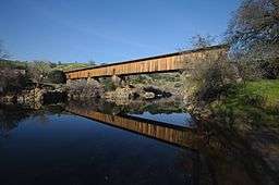
 The Knights Ferry covered bridge on the Stanislaus River in Stanislaus County | |
| Country | United States |
|---|---|
| State | California |
| Region | Central Valley |
| Part of | San Joaquin River |
| Tributaries | |
| - left | Middle Fork Stanislaus River, South Fork Stanislaus River |
| - right | North Fork Stanislaus River |
| Cities | Knights Ferry, Oakdale, Riverbank, Ripon |
| Source | Sierra Nevada |
| - location | Confluence of North Fork and Middle Fork Stanislaus River, Tuolumne County |
| - elevation | 1,230 ft (375 m) |
| - coordinates | 38°09′15″N 120°21′27″W / 38.15417°N 120.35750°W [1] |
| Mouth | San Joaquin River |
| - location | Near Ripon, San Joaquin County |
| - elevation | 20 ft (6 m) [1] |
| - coordinates | 37°39′54″N 121°14′27″W / 37.66500°N 121.24083°WCoordinates: 37°39′54″N 121°14′27″W / 37.66500°N 121.24083°W |
| Length | 96 mi (154 km), Northeast-southwest |
| Basin | 1,075 sq mi (2,784 km2) |
| Discharge | for Ripon |
| - average | 961 cu ft/s (27 m3/s) |
| - max | 62,500 cu ft/s (1,770 m3/s) |
| - min | 0.11 cu ft/s (0 m3/s) |
 Map of the Stanislaus River | |
The Stanislaus River (Spanish: Río Estanislao) in the U.S. state of California is one of the largest tributaries of the San Joaquin River. The river is 95.9 miles (154.3 km) long[2] and has north, middle and south forks. It drains a long, narrow area of the western Sierra Nevada and the northern part of the San Joaquin Valley.
Course
The river originates as North, Middle and South Forks along the crest of the Sierra Nevada, mainly in the Stanislaus National Forest. The Middle Fork, the longest at 45.7 miles (73.5 km), originates near Leavitt Peak and Sonora Pass, then flows southwest and west through a deep canyon to its confluence with the 31.2-mile (50.2 km) long North Fork. The confluence of these two forks forms the Stanislaus River proper. Directly downstream the river flows into New Melones Lake, the reservoir formed by the 625-foot (191 m) high New Melones Dam. The South Fork of the Stanislaus and a number of smaller tributaries join within New Melones Lake.
Downstream from New Melones Dam, there is Tulloch Dam, which forms Tulloch Reservoir, and Goodwin Dam, a smaller irrigation diversion dam. Below Goodwin Dam, the Stanislaus flows west through the Central Valley, past Oakdale, Riverbank and Ripon. Below Caswell Memorial State Park the Stanislaus meets the San Joaquin River which eventually flows into the Sacramento–San Joaquin River Delta.
Discharge
The Stanislaus River's historic annual streamflow is estimated at 1,125,000 acre feet (1.388×10⁹ m3), or more than 1,500 cubic feet per second (42 m3/s). The vast majority of the river flow comes from snowpack, and to a smaller extent rainfall, in the Sierra Nevada upstream of New Melones Lake. Almost two-thirds of the annual runoff occurs during the snowmelt season from April to July.[3]
Numerous dams and diversions have slowed the flow of the river, largely eliminating the sharp peaks that once resulted from rain floods in early winter and reducing the total amount of water entering the San Joaquin River. The United States Geological Survey (USGS) streamgage at Ripon, 15 miles (24 km) above the mouth, recorded an average streamflow of 952 cubic feet per second (27.0 m3/s) between 1941 and 2013, or about 689,500 acre feet (850,500,000 m3) per year. The highest peak was 62,500 cubic feet per second (1,770 m3/s) on December 24, 1955 (before the construction of New Melones Dam), and the minimum flow was 0.11 cubic feet per second (0.0031 m3/s) on August 4, 1977.[4] For comparison, the highest flow since the completion of New Melones in 1978 was 7,320 cubic feet per second (207 m3/s) on February 28, 1997.[5]
The USGS also operated a gage near Hathaway Pines, above New Melones Lake and the confluence with the South Fork, from 1967 to 1994. The average annual flow recorded here was 1,217 cubic feet per second (34.5 m3/s), or 881,300 acre feet (1.0871×10⁹ m3) per year.[6] The highest recorded peak was 46,200 cubic feet per second (1,310 m3/s), on February 19, 1986.[7]
Fish and wildlife
Before the Goodwin dam was built in 1912 the Stanislaus River supported large populations of spring-run and fall-run chinook salmon (McEwan 1996; Yoshiyama 1996). The original dam featured fish passage facilities, though it is unclear how effective this was at facilitating spawning runs. When the dam was raised in the 1950s it permanently blocked migration to major tributary spawning habitat in the Sierra Nevada. The chinook fall run has dropped from a predevelopment estimate of 35,000 to just 3,000–8,500.[8]
Human use
The Stanislaus River is extensively dammed and diverted, with a total of 30 major dams and reservoirs in the basin. Donnells Dam on the middle fork forms 65,000 acre·ft (80,000,000 m3) Donnell Reservoir, high in the Sierra Nevada. Downstream is Beardsley Dam, which forms the 97,500 acre·ft (120,300,000 m3) Beardsley Reservoir. These two dams are part of the Oakdale and South San Joaquin irrigation districts' Tri-Dam Project, which was originally built in the 1950s to store water for agriculture. Powerhouses at the dams generate a significant amount of hydroelectricity which are marketed by Pacific Gas and Electric (PG&E).[9]
McKays' Point Diversion Dam diverts water on the north fork for hydroelectricity production and domestic use. The 189,000 acre·ft (233,000,000 m3) New Spicer Meadow Reservoir is located on Highland Creek, a tributary of the North Fork. The powerhouses on the North Fork are collectively known as the North Fork Stanislaus River Hydroelectric Development Project and are jointly managed by the Northern California Power Agency (NCPA) and Calaveras County Water District (CCWD).[10]
The South Fork is dammed at Lyons Dam and Strawberry Dam. Strawberry Dam and Relief Dam on Summit Creek (a tributary of the Middle Fork) feed two powerhouses which comprise the Spring Gap-Stanislaus Hydroelectric Project, also owned by PG&E.[11] The Spring Gap Project diverts water from the South Fork into the Middle Fork, which flow less than 2 miles (3.2 km) apart at this point with an elevation difference of nearly 2,000 feet (610 m).
Below the confluence of the forks the earth-filled New Melones Dam forms New Melones Lake, which at 2,400,000 acre·ft (3.0 km3) is the fourth largest artificial lake in California. The dam was completed in 1979 by the U.S. Bureau of Reclamation to replace the original Melones Dam, a concrete arch structure built in 1926 to store water for irrigation. The new dam is operated to fulfill irrigation requirements, provide flood control and peaking power, and maintain minimum flow rates through the Sacramento–San Joaquin River Delta to combat salinity intrusion. The reservoir can store more than twice the annual flow of the Stanislaus River, but is often at a low level because its median water yield has proven lower than it was contracted for.[12]
Downstream from New Melones Dam lies Tulloch Dam, the lowermost component of the Tri-Dam project, with a storage capacity of 68,000 acre feet (84,000,000 m3). Goodwin Dam, located just below Tulloch, serves both as a diversion dam and a regulating reservoir for power releases from Tulloch. The dam diverts water into the Oakdale irrigation district's canal on the south bank, with a capacity of 560 cubic feet per second (16 m3/s), and the South San Joaquin irrigation district's canal on the north bank, with a capacity of 1,320 cubic feet per second (37 m3/s).[13] Up to 600,000 acre feet (0.74 km3), or 53% of the river's flow, are authorized for diversion here.[14] Further downstream, more water is diverted out of the river via canals for the Stockton East and Central California irrigation districts.[13]
History
The river is named for Estanislao, a Miwok leader from Mission San José, who led a band of 400 former mission acolytes against the Mexican government in 1828 and 1829. The band made its base along the banks of the river, then known as the Río de los Laquisimes. The word Laquisimes could be a Spanish loanword referring to the "Lakisamni",[15] an Amerindian tribe that lived on the Stanislaus near Knights Ferry. The rebellion was defeated in 1829 in battle against a force led by Mariano Vallejo.
The name Río de los Laquisimes had superseded an earlier name, Rio de Nuestra Señora de Guadalupe, given by explorer Gabriel Moraga during his travels of 1806-8.[16]
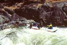
The Stanislaus is famous for a political battle over building the dam (which now forms New Melones Reservoir). The non-profit organization Friends of the River was formed to manage the fight, and has since worked to preserve rivers throughout California.[17] Prior to the construction of the dam and the flooding of the river, the lower Stanislaus was one of the most rafted whitewater runs in the United States. Rafting is still popular on the north fork of the Stanislaus and on the Goodwin Canyon section of the main Stanislaus. In long periods of drought, the Camp Nine run comes back as the lake level drops. In the early 1990s, this section was runnable for 3 years, with the river reaching the Highway 49 bridge before rains in 1993 brought the lake level all the way up above the put-in. In the summer of 2015, the reservoir was below the original Parrotts Ferry Bridge, and rafters were again running the Camp Nine stretch of the river.[18]
State parks
Caswell Memorial State Park

Caswell Memorial State Park contains one of the rare stands of native oak trees found in the Central Valley. Located near Ripon, Caswell State Park is located on the Stanislaus River. There are two beaches, Salmon Beach located in the campgrounds, and Public Beach located in the day use area. Many campers will take inflatable rafts down the river starting at Salmon Beach and exiting at Public Beach. The river is also used by hobbyist gold diggers who pan the river for gold.
Covered bridges

Byrne's ferry bridge
One of the few remaining covered bridges in California crossed the Stanislaus River and was originally called the Byrne's Ferry bridge, named after the P. O. Byrne ferry which once crossed at the same point. Originally a chain cable suspension bridge with a plank floor, it was completed in the spring of 1853 and was opened to the public as a toll bridge. The suspension bridge was destroyed in the floods, and a new covered cantilever bridge of Howe truss type and reinforced by an auxiliary arch was built in 1862. Built and run by the Union Bridge Company, a corporation with headquarters at Sonora, Joe Pardies profitably operated the toll bridge for many years.
Frederick Russell Burnham, the celebrated scout, was largely responsible for the Byrne's Ferry bridge being purchased by the counties. In the late 1880s and early 1890s, Burnham was a cattleman in the region and during his annual summer trips into the mountains for better feed he drove his cattle across the bridge at a cost of $25 or $30 for the herd. Because he was dissatisfied with the condition of the bridge, and because he disliked paying the toll fee, Burnham circulated a petition for the bridge to be purchased by the two counties and to be made a free bridge. In 1902, the petition passed and the counties of Calaveras and Tuolumne purchased the bridge for $4,000 and the toll was discontinued.[19]
It is claimed that the Californio bandit Tiburcio Vasquez held up the stage running between Chinese Camp and Copperopolis nearby. Wells Fargo posted a reward for his arrest and conviction and a posse was formed at Poker Flat which then crossed the Byrne's Ferry bridge in pursuit of the bandit. Vasquez escaped only to be captured later in San Jose and hanged not long after.
The Tri-Dam project and the Tulloch Reservoir eventually ended the story of the covered bridge. When filled to capacity, the reservoir backs river water up the canyon for seven miles and forms a large lake that covers the O'Byrne's Bridge site to a depth of eighty feet. In 1957, as the reservoir began to fill, the directors of the two irrigation districts studied the possibility of either burning the bridge where it stood or simply cutting it free from its moorings. But the Calaveras and Tuolumne County Historical Societies and the Copperopolis Community Club, assisted by the Native Sons of the Golden West and many other statewide groups, took an interest in saving the bridge. They started what was known as a "DOLLAR" campaign to cover the cost of preserving the bridge as a future landmark; estimated at the time to be about $9,000. A plan was developed to move the bridge down-stream to a lagoon created by the reservoir where it could span an inlet and once again become a tourist attraction. The California State Parks Commission endorsed the proposal and a Tuolumne County rancher agreed to donate the property upon which the bridge could be located. However, such plans failed to materialize.
On the morning of October 21, 1957, the Calaveras and Tuolumne County supervisors sold the bridge at auction. Several attempts were made to blast the bridge from its supports using dynamite, but the charges were insufficient. As the water rose, the bridge eventually gave up its supports but by then it was partially submerged. Unable to save the bridge, the structure was dismantled and some of the lumber was used to build the nearby resorts. About 3,000 feet upstream from where the old covered bridge stood, a new concrete and steel bridge was built in 1958 at a cost of $458,355.
See also
References
- 1 2 3 4 U.S. Geological Survey Geographic Names Information System: Stanislaus River
- ↑ U.S. Geological Survey. National Hydrography Dataset high-resolution flowline data. The National Map, accessed March 11, 2011
- ↑ http://www.waterrights.ca.gov/baydelta/docs/southerndeltasalinity/sewd010807_exhibitB.pdf
- ↑ http://wdr.water.usgs.gov/wy2013/pdfs/11303000.2013.pdf
- ↑ http://nwis.waterdata.usgs.gov/nwis/peak?site_no=11303000&agency_cd=USGS&format=html
- ↑ http://nwis.waterdata.usgs.gov/nwis/monthly/?referred_module=sw&site_no=11295401&por_11295401_1=2208929,00060,1,1967-08,1994-09&format=html_table&date_format=YYYY-MM-DD&rdb_compression=file&submitted_form=parameter_selection_list
- ↑ http://nwis.waterdata.usgs.gov/nwis/peak?site_no=11295400&agency_cd=USGS&format=html
- ↑ http://sanjoaquinbasin.com/stanislaus-river.html
- ↑ http://www.waterboards.ca.gov/waterrights/water_issues/programs/water_quality_cert/docs/springgap_stanislaus_ferc2130/pge_variance_amend_request.pdf
- ↑ http://www.ncpahydro.com/about.htm
- ↑ http://www.waterboards.ca.gov/waterrights/water_issues/programs/water_quality_cert/springgap_ferc2130.shtml
- ↑ http://www.usbr.gov/projects/Project.jsp?proj_Name=New%20Melones%20Unit%20Project
- 1 2 http://www.waterboards.ca.gov/centralvalley/water_issues/salinity/lower_sanjoaquin_river_committee/administrative_materials/2011apr28/2011apr28_mtg_ag_item4_rsrc_dev.pdf
- ↑ http://www.ssjid.com/district-services/agriculture-irrigation-water.htm
- ↑ The Indian tribes of North America. Retrieved 3 April 2011.
- ↑ Gudde, E. G., & Bright, W. (1998). California place names: The origin and etymology of current geographical names. Berkeley: University of California Press.
- ↑ Gaguine, Alexander, The Campaign to Save the Stanislaus River - 1969 to 1982 And its Historic Importance, Headwaters, Fall/Winter 2009,
- ↑ "California Drought Revives a River — and a Poignant History". KQED Science. Retrieved 2016-01-18.
- ↑ Coke Wood. "Old Corner:O'Byrne's Ferry Covered Bridge at Poker Flat". Old Timers Museum in Murphys, CA. Retrieved 2009-02-02.
- "Old Corner". Old Corner Saloon. Retrieved 2007-10-23.
External links
| Wikimedia Commons has media related to Stanislaus River. |