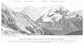
Punta San Matteo
Punta San Matteo is a secondary peak of Ortler-Vioz in the Ortler Alps, at the border between the Province of Sondrio (Lombardy region) and Trentino (Trentino-Alto Adige/Südtirol region) in northern Italy.
It was the scene of the Battle of San Matteo in World War I, which, until the 1999 Kargil war, has been the highest battlefield in modern warfare history.
| Punta San Matteo | |
|---|---|
 | |
| Highest point | |
| Elevation | 3,678 m (12,067 ft) |
| Coordinates | 46°22′44″N 10°34′00″E / 46.37889°N 10.56667°ECoordinates: 46°22′44″N 10°34′00″E / 46.37889°N 10.56667°E |
| Naming | |
| Translation | Saint Matthew's Peak (Italian) |
| Geography | |
 Punta San Matteo Italy | |
| Location | Border between Lombardy and Trentino-Alto Adige/Südtirol |
| Parent range | Ortler Alps |
| Climbing | |
| First ascent | 28 June 1865 by Francis Fox Tuckett, Douglas William Freshfield, James Backhouse, George Henry Fox, François Devouassoud and Peter Michel |
Further reading
- Peter Holl: Alpenvereinsführer Ortleralpen, 9. Auflage, Munich (2003) ISBN 3-7633-1313-3 OCLC 231128013
- The Alpine Journal, Volume III, page 145, London 1865
- Eduard Richter (Redaktion): Die Erschließung der Ostalpen, II. Band, Verlag des Deutschen und Oesterreichischen Alpenvereins, Berlin, (1894)
- Casa Editrice Tabacco, Udine: Carta topografica 1:25.000, Blatt 08, Ortles-Cevedale/Ortlergebiet
This article is issued from Wikipedia - version of the 4/13/2014. The text is available under the Creative Commons Attribution/Share Alike but additional terms may apply for the media files.