Placencia Airport
| Placencia Airport | |||||||||||
|---|---|---|---|---|---|---|---|---|---|---|---|
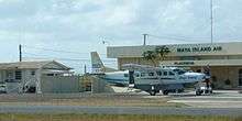 A Maya Island Air Cessna Caravan at Placencia Airport | |||||||||||
| IATA: PLJ – ICAO: none | |||||||||||
| Summary | |||||||||||
| Airport type | Public | ||||||||||
| Operator | n/a | ||||||||||
| Serves | Placencia | ||||||||||
| Elevation AMSL | 42 ft / 14 m | ||||||||||
| Coordinates | 16°32′13″N 088°21′42″W / 16.53694°N 88.36167°WCoordinates: 16°32′13″N 088°21′42″W / 16.53694°N 88.36167°W | ||||||||||
| Map | |||||||||||
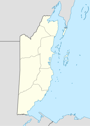 Placencia Airport Location in Belize | |||||||||||
| Runways | |||||||||||
| |||||||||||
Placencia Airport (IATA: PLJ) is an airport that serves Placencia, Belize. It has a paved strip and crosses the peninsula from East to West.[3]
As of December 2012, the runway is paved in good condition. There are short obstacles at either end of the runway, however brush does extend roughly 10 ft high off center of either end. Brush on either side of the runway was recently trimmed as of a December 2012 flight. Although the airport is primarily served by high-wing singles, a Cessna 310 was able to take off and land comfortably with clearance to side brush. Due to the nature of brush growth, it is wise to inquire as to current state of brush prior to flight in any low-wing aircraft, especially ones with minimal ground clearance.
Due to the typical sea breeze, takeoffs and landings are typically done east-bound. Private flights are allowed. Parking should be coordinated with Tropic Air or Maya Island Air. The airport has no security.
Common traffic advisory frequency (CTAF) is 122.8 MHz.
Scheduled Service
| Airlines | Destinations |
|---|---|
| Maya Island Air | Belize City-International, Belize City-Municipal, Dangriga, Punta Gorda |
| Tropic Air | Belize City-International, Belize City-Municipal, Dangriga, Punta Gorda |
See also
 Belize portal
 Aviation portal
- List of airports in Belize
References
- ↑ Airport information for PLJ at Great Circle Mapper.
- ↑ Google Maps - Placencia
- ↑ Landing at Palencia YouTube