Phagwara railway station
Phagwara | |
|---|---|
| Indian Railway Junction Station | |
| Location |
National Highway 1, Phagwara, Punjab India |
| Coordinates | 31°13′01″N 74°45′54″E / 31.217°N 74.765°ECoordinates: 31°13′01″N 74°45′54″E / 31.217°N 74.765°E |
| Elevation | 245 metres (804 ft) |
| Owned by | Indian Railways |
| Operated by | Northern Railway |
| Line(s) |
Ambala-Attari line Phagwara-Nawan Shahr Doaba branch line |
| Platforms | 3 |
| Tracks | Broad gauge 1,676 mm (5 ft 6 in) |
| Construction | |
| Structure type | Standard on ground |
| Parking | Yes |
| Bicycle facilities | No |
| Other information | |
| Status | Functioning |
| Station code | PGW |
| Division(s) | Firozpur |
| History | |
| Opened | 1870 |
| Location | |
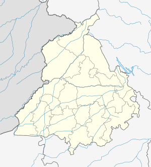
 Phagwara railway station Location in Punjab | |
Phagwara railway station is located in Kapurthala district in the Indian state of Punjab and serves the textile town of Phagwara .
The railway station
Phagwara railway station is at an elevation of 245 metres (804 ft) and was assigned the code – PGW.[1]
History
The Sind, Punjab and Delhi railway completed the 483 km (300 mi) long Amritsar-Ambala-Saharanpur-Ghaziabad line in 1870 connecting Multan (now in Pakistan) with Delhi.[2]
Electrification
the Phillaur-Phagwara sector was electrified in 2002-03, and the Phagwara-Jallandhar City-Amritsar sector in 2003-04.[3]
References
- ↑ "Arrivals at Phagwara". indiarailinfo. Retrieved 20 Februru5ary 2014. Check date values in:
|access-date=(help) - ↑ "IR History: Early Days II (1870-1899)". IRFCA. Retrieved 20 February 2014.
- ↑ "History of Electrification". IRFCA. Retrieved 20 February 2014.
External links
| Preceding station | Indian Railways | Following station | ||
|---|---|---|---|---|
Mauli | Northern Railway zone | Chileru |
||
| Terminus | Northern Railway zone Phagwara-Nawan Shahr Doaba branch line | Bahram |
This article is issued from Wikipedia - version of the 1/21/2016. The text is available under the Creative Commons Attribution/Share Alike but additional terms may apply for the media files.