Paintsville Lake State Park
| Paintsville Lake State Park | |
|---|---|
|
Paintsville Lake | |
 Location in Kentucky | |
| Type | Kentucky state park |
| Location | Johnson County, Kentucky |
| Coordinates | 37°50′23.34″N 82°52′15.56″W / 37.8398167°N 82.8709889°WCoordinates: 37°50′23.34″N 82°52′15.56″W / 37.8398167°N 82.8709889°W |
| Area | 242 acres (98 ha) |
| Created | 1986 |
| Operated by | Kentucky Department of Parks |
| Status | Open year-round |
| Paintsville Lake State Park Official website | |
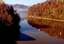
Paintsville Lake State Park is a park located just west of Paintsville, Kentucky in Johnson County. The park itself encompasses 242 acres (98 ha), while Paintsville Lake, its major feature, covers approximately 1,139 acres (461 ha) extending into parts of Morgan County.[1]
The park contains thirty-two developed campsites, ten primitive campsites, a playground, four picnic shelters, a four lane launch ramp, an amphitheater,[2] a restaurant, a marina, and a Kiwanis Trail.[3] The park also contains the Mountain Homeplace,[4] which is a replica of a small farming community in Eastern Kentucky between 1850 and 1900, and has an adjacent 12,103-acre (4,898 ha) wildlife management area.[5]
Gallery
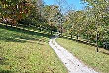
 The Kiwanis Trail
 Rocky Knob Recreational Area
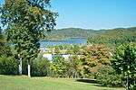
 Paintsville Lake and marina
 Mountain Homeplace
References
- ↑ Kleber, John E., ed. (1992). "Parks, State". The Kentucky Encyclopedia. Associate editors: Thomas D. Clark, Lowell H. Harrison, and James C. Klotter. Lexington, Kentucky: The University Press of Kentucky. ISBN 0-8131-1772-0.
- ↑ "In the Pines Amphitheater". Paintsville Tourism. Retrieved September 19, 2013.
- ↑ "Kiwanis Walking Trail". Paintsville Tourism. Retrieved September 19, 2013.
- ↑ "Paintsville Lake". United States Army Corps of Engineers Huntington District. Retrieved September 19, 2013.
- ↑ "Paintsville Lake WMA". Kentucky Department of Fish and Wildlife Resources. Retrieved September 19, 2013.
External links
- Paintsville Lake State Park Kentucky Department of Parks
- Paintsville Lake Facilities Map Kentucky Department of Parks
- Paintsville Lake Area Interactive GIS Map Commonwealth of Kentucky
- Mountain Homeplace
This article is issued from Wikipedia - version of the 11/13/2016. The text is available under the Creative Commons Attribution/Share Alike but additional terms may apply for the media files.


