Oum Zebed
| Oum Zebed | |
|---|---|
| Village | |
 Oum Zebed | |
| Coordinates: DZ 33°7′36″N 6°21′8″E / 33.12667°N 6.35222°ECoordinates: DZ 33°7′36″N 6°21′8″E / 33.12667°N 6.35222°E | |
| Country |
|
| Province | Ouargla Province |
| District | Taibet District |
| Commune | M'Naguer[1] |
| Elevation | 100 m (300 ft) |
| Time zone | CET (UTC+1) |
population
people of oum zebed belongs to Arch "Ouled Sayah" (Arch means clan ),named after the ancestor of these peaple and many others in the region nearby, who is Sidi Mohammed Sayah originally from telemcen city, he was called sayah which means " voyager " because of his journeys from telemcen towards many placese,
References
- 1 2 "Décret n° 84-365, fixant la composition, la consistance et les limites territoriale des communes. Wilaya d'El Oued" (PDF) (in French). Journal officiel de la République Algérienne,. 19 December 1984. p. 1551. Archived from the original (PDF) on 2 March 2013 or before. Retrieved 2 March 2013. Check date values in:
|archive-date=(help) - ↑ "Oum ez Zebed, Algeria". Google Maps. Retrieved 4 May 2013.
Neighbouring towns and cities
 |
Sidi Slimane | El Oued | | |
| Touggourt | |
Benaceur | ||
| ||||
| | ||||
| Balidat Ameur Ouargla |
Hassi Messaoud | Taibet |
Capital: Ouargla | ||
| Ouargla District | 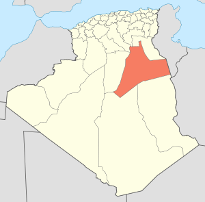 | |
| El Borma District | ||
| El Hadjira District | ||
| Hassi Messaoud District | ||
| Mégarine District | ||
| N'Goussa District | ||
| Sidi Khouïled District | ||
| Taïbet District | ||
| Témacine District | ||
| Touggourt District | ||
This article is issued from Wikipedia - version of the 9/15/2016. The text is available under the Creative Commons Attribution/Share Alike but additional terms may apply for the media files.