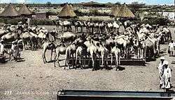
North Kurdufan
| North Kurdufan شمال كردفان Shamal Kurdufan | ||
|---|---|---|
| State | ||
 | ||
| ||
.svg.png) Location in Sudan. | ||
| Coordinates: 14°22′N 29°32′E / 14.367°N 29.533°ECoordinates: 14°22′N 29°32′E / 14.367°N 29.533°E | ||
| Country |
| |
| Region | Kurdufan | |
| Capital | Al-Ubayyid | |
| Government | ||
| • Governor | Ahmed Haroun | |
| Area | ||
| • Total | 185,302 km2 (71,546 sq mi) | |
| Population (2006 est.) | ||
| • Total | 2,529,370 | |
| Time zone | EAT (UTC+3) | |

North Kurdufan (Arabic: شمال كردفان Šamāl Kurdufān) is one of the 18 wilayat or states of Sudan. It has an area of 185,302 km² and an estimated population of 2,920,890 (2008 census) (3,340,000 (2011 estimate)). Al-Ubayyid is the capital of the state.
North Kurdufan is generally arid and desert.
History
For centuries, North Kurdufan was inhabited by nomads and pastoralists, mainly the Dar Hamid, Dar Hamar, Guamaa, Kababish, Bideriya, Shwehat and including the Yazeed tribes.[1] The area has had almost continuous drought since the mid-1960s. Deforestation led to the destruction of the natural vegetation. NGOs working in the villages of Sudan tried to rectify the damage. They set up women's centres. These centres allowed many women gain an income. Training was introduced and a solar energy system set up. NGOs recognise that a need exists for longer projects requiring the kind of support that only can come from governments and large agencies.
Cities and towns in North Kurdufan
- Al-Ubayyid
- Al-Nuhud
- Er Rahad
- Um-Rwaba
- Bara
- Gibaish
- Sodari
- Abu Zabad
- Umm Dam
See also
- 2007 Sudan floods
- Kurdufan - overall region.
References
- ↑ "Joshua Project - Yazeed". Retrieved 2008-02-05.
